Tag Archives: sea ice

Arctic mammals and the big picture

Arctic mammals linked to sea ice
polar bear (Ursus maritimus)
narwhal (Monodon monoceros)
beluga (Delphinapterus leucas)
bowhead (Balaena mysticetus)
ringed seal (Pusa hispida),
bearded seal (Erignathus barbatus)
spotted seal (Phoca largha)
ribbon seal (Phoca fasciata)
harp seal (Pagophilus groenlandicus)
hooded seal (Cystophora cristata)
walrus (Odobenus rosmarus)

It’s looking more and more likely that sea ice in the Arctic has broken yet another ominous record – the lowest winter extent ever recorded. While low ice in the winter isn’t necessarily a harbinger of much less ice in the Arctic summer, it is a sign of increasingly thin, slow growing ice – and that’s bad news for Arctic animals.
But just how bad? A new paper published this week is the first to assess the state of the Arctic’s ice-dependent marine mammals – 11 in all. From whales to seals to polar bears, these species depend on the seasonal comings and goings of the ice edge to find food, breed and give birth. Arctic people, especially the Inuit, depend on these animals for subsistence. The well-being of these animals matters both locally and globally.
Despite their importance, there’s still a lot we don’t know about Arctic mammals. The paper, Arctic marine mammal population status, sea ice habitat loss, and conservation recommendations for the 21st century, fills in some gaps by collating everything we know about the populations of 11 different Arctic mammals over the past 35 years – a time of rapid ice loss and thinning. Some of the paper’s findings:
 

Head of ringed seal above the water. Blomsterhalvøya, Spitsbergen (Svalbard) arctic archipelago, Norway. © WWF-Canon / Sindre Kinnerød

Head of ringed seal above the water. Blomsterhalvøya, Spitsbergen (Svalbard) arctic archipelago, Norway.
© WWF-Canon / Sindre Kinnerød

More open water in the summer

Changes in ice can disrupt life for both prey (seals give birth on ice during a short spring window) and predators (polar bears feast on the fat-rich new pups).  Since the 1980s, some parts of the Arctic have seen much longer periods of open water in the summer – from 5 weeks to as much as 5 months longer.

File photograph of a bowhead whale. Photo: WWF/Paul Nicklen, National Geographic Stock

File photograph of a bowhead whale. Photo: WWF/Paul Nicklen, National Geographic Stock

Population trends vary, but ice is key

Data in the Arctic can be spotty, but the researchers founds some clear trends. In areas where ice is declining quickly, mammals that depend on ice are too.  Seals and polar bears are particularly affected. Whales, meanwhile, could benefit from less ice in the short term, as open water expands their habitat and food supplies.
However, temperate species are also expanding their ranges. Killer whales, with a long dorsal fin that makes navigating in ice difficult, are moving north into previously icy waters where they prey on Arctic whales.
Ice dependent mammals, likewise, may move north when possible. Polar bears, for example, are already moving towards the Last Ice Area, a fringe along northern Canada and Greenland where ice is expected to remain the longest.

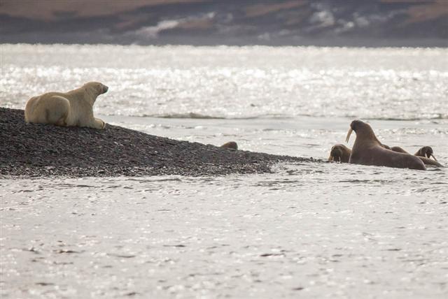
“Sleeping” polar bear waits for a walrus calf to come close. Photo: Alexey Ebel / WWF-Canon

“Sleeping” polar bear waits for a walrus calf to come close. Photo: Alexey Ebel / WWF-Canon

More info needed

For most of the populations reviewed, there simply isn’t much data available. “Accurate scientific data – currently lacking for many species – will be key to making informed and efficient decisions about the conservation challenges and tradeoffs in the 21st century,” says author Kristin Laidre.
Although monitoring every population fully is essentially impossible (due not least to financial constraints), the authors encourage goverments to commit to an improvment in long-term monitoring, and to look at other methods of data collection, such as working with subsistence hunters or exploring remote technologies.

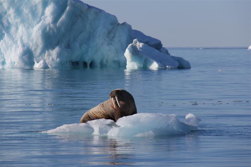
_ Students on Ice _ walrus on ice (Medium)

Walrus, Nunavut, Canada. Photo: Students on Ice


What can we do?

In an environment that’s changing so quickly, conservation measures need to be fast, creative and well-balanced. The authors recommend that governments continue to work with local and indigenous peoples to co-manage Arctic mammal populations. They also suggest that management consider the responses of different species to changes in ice, and more study and mitigation of industrial impacts in Arctic water.
That means protecting the key habitats for these mammals, and avoiding risky industrial development projects in such crucial places.
WWF also recommends focusing attention on places where ice will persist the longest, like the Last Ice Area.
But ultimately, only global commitments to reduce carbon emissions can slow the loss of sea ice habitat in the Arctic. “We may introduce conservation measures or protected species legislation, but none of those things can really address the primary driver of Arctic climate change and habitat loss for these species,” says Laidre.
A global switch from fossil fuels to wind, solar and other renewable energies can help reverse ice loss in the Arctic. A WWF study found that it is not only feasible, but cost-effective, for 100% of the world’s energy to come from renewable sources by 2050.
The real value of Arctic resources

Photo: Brutus Ostling / WWF-Canon

Svalbard, Norway. Photo: Brutus Ostling / WWF-Canon


WWF-Norway’s Nina Jensen speaks this week at the 2015 Arctic Frontiers conference about the future of energy in the Arctic.
As the annual Arctic Frontiers meeting starts in Tromso, Norway, much of the talk and media coverage will once again be centred on Arctic resources. This is usually code for oil and gas development in the Arctic, and the potential geopolitical conflict over the exploitation of these resources. This focus is entirely misguided.
The Arctic’s most significant renewable resources are ice and snow. The ice and snow in the Arctic reflect significant amounts of the sun’s energy. As we lose that reflective shield, the Arctic absorbs more solar energy. A warming Arctic warms the entire planet, causing billions of dollars’ worth of avoidable damage, displacing millions of people, and throwing natural systems into disarray. We continually undervalue the critical role of the Arctic is shielding us from wrenching change. Instead, we ironically look to it as a source of the very hydrocarbons that are melting away the Arctic shield.

Arctic oil and gas is risky business

Apart from the question of whether we should be developing hydrocarbon resources anywhere in the world, let us look at the question of specifically developing them in the Arctic, which in many cases means the offshore Arctic, under the ocean.
We know there are no proven effective methods of cleaning up oil spills in ice, especially in mobile ice. Even without ice, the effects of a spill in Arctic conditions will linger for decades. Oil from the Exxon Valdez spill in Alaska still pollutes beaches, more than 25 years later. We know that drilling for oil in the offshore Arctic is extremely risky – just look at the mishaps that Shell has encountered in the last couple of years in its attempts to drill off the Alaskan Coast. So there is a high risk of mishap, and no proven effective method of cleaning up after such a mishap. No matter what the price of oil, $50 or $200 a barrel, is it worth the risk?

The Arctic can be a proving ground for green technology

We do not need to make the same mistakes in the Arctic as we have made elsewhere. We can instead use the Arctic as a proving ground for greener, cleaner technologies. Tidal power, wind power, hydro power, all have potential in the Arctic. The Arctic, with its smaller population centres is ideal for smaller scale technologies to produce such renewable power. Such local power generation can create local jobs, and make Arctic communities more self-sufficient, able to withstand the fluctuations in price of petroleum-based fuels that will eventually bankrupt them.
This message is not just coming from WWF. If you look at the US government plans for its chair of the Arctic Council starting later this year, it also recognizes the value of replacing fossil fuels with community-based renewable power sources – it also just put the valuable fishery of Bristol Bay off limits to oil and gas development. So it’s not just NGOs and Arctic peoples who are questioning the value of fossil fuels in the Arctic, versus the real value of the Arctic to the world – as a regulator of our global climate.

Finding the Arctic’s most important marine habitats

This article is reprinted from The Circle 4.14. Jake Rice is the Chief Scientist for Canada’s Dept. of Fisheries and Oceans, providing advice for international and domestic marine policy and management, including the EBSA process.

Developing scientific criteria for determining ecologically or biologically significant areas (EBSAs) was one of the key components of Canada’s plans to implement the Oceans Act in 1997. These criteria highlight waters that may have high functional significance for species that use the area; are fragile or highly vulnerable to perturbation; serve as centres of aggregation for populations; or are otherwise exceptionally diverse or productive. These criteria have since been applied to all of Canada’s marine areas and are proving to be of value in freshwater systems as well.
Initial meetings to apply the criteria in the more southern areas of Canada’s Atlantic and Pacific oceans relied primarily on extensive and spatially resolved sets of systematically-collected scientific data sets. When attention turned to the Beaufort Sea and Arctic Archipelago there were fewer such data sets, and their coverage was often limited in space and time. DFO turned to social scientists who worked with Elders and long-time residents of the Canadian North to record knowledge of areas of ecological or biological significance in ways that were culturally respectful and directly usable in the expert meetings for those two Arctic marine areas. The process for meeting and collecting this knowledge took time, but no more time than consolidating all the data sets of oceanographic and biological information in other areas. Some EBSAs were indeed recognized based on “scientific” data sets from remote sensing or ship-based surveys of ocean productivity, current patterns, and ice conditions, or by technologies for tracking tagged animals. Many others were identified based on Inuit and Aboriginal knowledge of migration routes of marine mammals and where they bred, fed, and overwintered, or areas where they have long fished or found seabirds. Often the available scientific data and knowledge of the Indigenous people worked in complementary ways to highlight the areas that were most significant on one or several of the criteria. Maps of all the EBSAs that have been identified are available here, along with rationales for each one.
The process of identifying the EBSAs focused on information-sharing and objectively using the knowledge from all sources to identify the areas that best reflected the pre-adopted criteria. The maps and justifications of EBSAs that were produced are rich in information. But maps are only maps until they are used as a resource for planning and management. This is where we are seeing concrete evidence that the time invested in creating them was time well spent.

Maps are only maps until they are used as a resource for planning and management.

First of all, in the process of applying the criteria, we learned some things about EBSAs that had not been grasped before. In the Arctic, many of the areas found to be ecologically or biologically significant got much of their significance from the position and nature of the ice front, which of course moves seasonally. For the first time, the meetings delineated EBSA boundaries that might have encompassed the entire area covered by the ice edge from its winter maximum to its summer minimum. But the justifications stress that within those larger boundaries, the features that made the area special would be found in association with the smaller subarea where the ice edge was located at any particular time. Importantly, the management implication of that situation was spelled out. In planning for activities that involve permanent built infrastructure, the entire area in the EBSA boundary needs to be considered as requiring particularly risk-averse management. In planning for activities which are inherently mobile, such as ecotourism or fishing, risk-averse management is still needed, but should be focused on the much smaller sub-area where the ice front is located at the time the activity is occurring. Since the Arctic EBSA workshops, this way of thinking about different kinds of EBSAs has spread to oceans all over the world, at is applies equally well to important features like oceanographic fronts.
So we now have these maps of EBSAs and their individual justifications. Are they making a difference? The short answer is that it is too soon to tell. Planning for uses and, where appropriate, protection of the Arctic is an ongoing process. Plans such as the Integrated Ocean Management Plan for the Beaufort Sea make extensive use of the results of the EBSA identification process in developing the plan. However that Plan is still fairly high level, implementing the concepts is another piece of work. What, if anything, ends up being different in the EBSAs versus other parts of the Arctic remains to be seen. Importantly though, the EBSAs are part of all the discussions for other topics such as Marine Protected Area networks in the Arctic, the routing of shipping, tourism etc. Having the information systematically available is already helping. As the EBSA identification process spreads to the rest of the Arctic, and as information accumulates and areas are reviewed, it can only get better.

Where the ocean blooms


© Wild Wonders of Europe /Magnus Lundgren / WWF

© Wild Wonders of Europe /Magnus Lundgren / WWF


This article is reprinted from The Circle 4.14. Dr. Jan-Gunnar Winther is a hydrologist and director of the Norwegian Polar. Dag Vongraven is a biologist and senior adviser at the Environmental and Mapping Department of the Norwegian Polar Institute. He also chairs the IUCN/SSC Polar Bear Specialist Group.
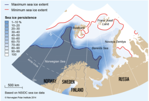
The ice edge is rarely a neat line. Rather, it comprises a dynamic zone of varying degrees of ice cover between open water and 100 per cent ice cover.
Dependent on current and wind conditions, it can change from being a fairly narrow, well-defined edge, to a swath of ice-floes tens of kilometres broad. It is in constant motion, moving north- or southwards during the seasons. The outer rim of the sea ice which is close enough to the open ocean boundary to be affected by its presence is often called the Marginal Ice Zone (MIZ) or the Sea Ice This zone of high biological production is particularly vulnerable to human impact. In addition to its role in moderating regional and global climate, sea ice needs to be taken into consideration when assigning new licenses for oil and gas prospecting in the Barents Sea.

For a few weeks in spring, the Sea Ice Zone becomes a hotbed of primary production, a blooming garden of plant plankton and ice algae.

sea-ice-persistence

Map showing maximum and minimum sea ice extent in the month of April in the years from 1984 to 2013, as well as ice persistence in 10% increments. Ice persistence is the frequency of April days with ice concentration greater than 15% in any given pixel/area in the material the maps is based on.


An important and vulnerable garden
For a few weeks in spring, the Sea Ice Zone becomes a hotbed of primary production, a blooming garden of plant plankton and ice algae. Zooplankton feed on these, and they in turn are prey for larger animals. From its outer edge and throughout the area where the light penetrates the ice cover, the Sea Ice Zone is more ecologically vulnerable than other parts of the ocean.
Primary production takes place across the world’s oceans, but nowhere is it as concentrated in time and space as in the Sea Ice Zone. A more predictable and denser patch of food than the open ocean, the Sea Ice Zone is an important feeding ground for a variety of animals, including ivory gulls, ringed seals, polar bears, narwhals, beluga and bowhead whales. Many of these are nationally or internationally protected and/or endangered species. The area provides crucial habitats and foraging areas for other key species in the Arctic ecosystem, such as capelin and polar cod, which are prey for other species of marine birds and mammals. It is also an important resting place for migrating species of marine birds and mammals – a biological hot spot.
A challenge for managing the Arctic
Many environmental values vary in time and space, as does the sea ice. Properly managing dynamic systems such as ice-covered waters is a substantial challenge. Diminishing sea ice presents opportunities for the expansion of human activities in the Arctic in the near future. Human influence may negatively affect stocks and populations of many Arctic species. Contributing to the integrated, knowledge-based management of the region, the Norwegian Polar Institute has recently assembled statistics on sea ice conditions in the Barents Sea and described the vulnerability of this area. The Institute also provides knowledge on ecosystems and physical conditions in the Arctic, including sea ice. It has described this zone based on satellite monitoring of the ice cover for the last 30 years (1984-2013) and produced maps to show variations in the timing and location of sea ice during each month of the year.
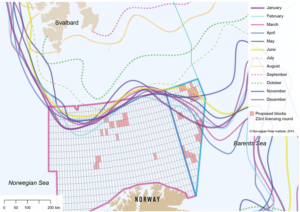
Monthly maximum sea ice extent for the period 1984-2013. Suggested licenses in the 23rd licensing round are shown as squares on the map.

Monthly maximum sea ice extent for the period 1984-2013. Suggested licenses in the 23rd licensing round are shown as squares on the map.


The 23rd licensing round for oil and gas prospecting in the south-eastern part of the Barents Sea opens the door for petroleum activities further northwards than ever before. In a consultative statement to the Norwegian authorities, the Norwegian Polar Institute has pointed out the vulnerability of this region on account of the seasonal presence of sea ice and a general lack of knowledge of the area and its variability. The proposed hydrocarbon exploration areas will be closer to vulnerable seabird colonies on the island of Bjørnøya (Spitsbergen archipelago), closer to the maximum extent of sea ice, overlapping the Polar Front, in the south-eastern part of the Barents Sea and partly within areas which have been defined as particularly valuable and vulnerable in the Integrated Management Plan for the Norwegian Part of the Barents Sea and the Areas outside Lofoten.
The Institute has also highlighted the need for increased preparedness for oil spills and other accidents in the region.

The Arctic by ship – what we learned about change

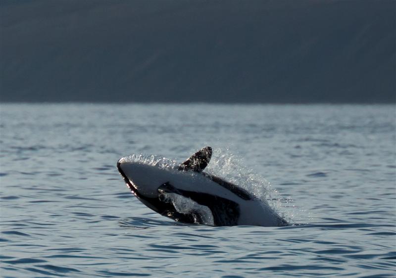
Orca, Tremblay Sound.© Pascale Otis / Students on Ice

Orca, Tremblay Sound.© Pascale Otis / Students on Ice


Arctic Tern I is a polar expedition vessel acquired by the Students on Ice Foundation in partnership with WWF to provide a safe, environmentally friendly, cost effective, and versatile platform for education, research and media projects in the Arctic. In summer 2013, Arctic Tern I headed to the eastern Canadian Arctic and on the first of a five-year mission to assess biodiversity in this important and fast-changing part of the world, and contribute to constructive and collaborative solutions for a sustainable future.
Polar sailors and scientists Grant Redvers and Pascale Otis share their experiences and photos from the journey, in the third of a four-part series (part 1 , part 2).
The past two summers have allowed us to learn a lot about how the Arctic is changing, both from our own observations and by talking with the locals in northern communities. For example…

Development is increasing

Just in the time we have been sailing in west Greenland and the eastern Canadian Arctic, we have seen a large increase in shipping associated with resource development (mining and oil and gas exploration).

Hunting is more difficult

Hunters spoke to us about changes in the migration timing and pathways of many species, including caribou, narwhal and polar bear.

Less sea ice, unpredictable weather

Both scientific and anecdotal evidence clearly shows a reduction in summer sea ice in the Arctic. Although it is difficult for us to see this trend from just a few seasons sailing, long term monitoring, and stories from elders show that this is a very real manifestation of climate change. Over the short term that we have observed, from season to season, sea ice cover and weather patterns have proved to be more erratic, and more difficult to predict.

More ship traffic

This year, about 30 small yachts tried to transit the Northwest Passage (compared to 2 in 2006)! Although reliable commercial shipping through the passage is still some time away in the Canadian Arctic, there has been a marked increase in commercial traffic through Russian waters in recent years. With such an increase in traffic issues like search and rescue, pollution control is of key concern.

New species are moving north

This year, we filmed orcas in the north predating on narwhal… something that had never been filmed before! Although this is thought to have occurred for a number of years, it is still a poorly understood species interaction that might be related to climate change and reducing sea ice, allowing orcas to extend their range. We have heard similar stories of Pacific salmon being caught in the eastern Canadian Arctic.

Welcome to the polar bear capital of the world

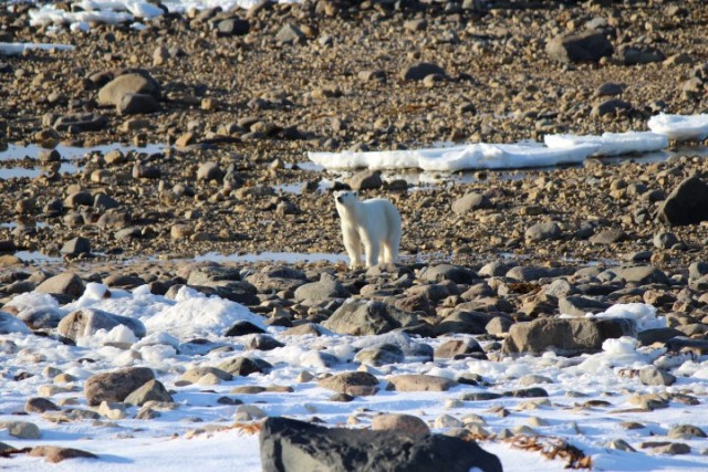
Waiting for ice in Churchill

Waiting for ice in Churchill. © Geoff York

It’s November, which means one thing for polar bears in Churchill Manitoba – it’s time to get more active and start looking for sea ice.

Polar bears come ashore in Hudson Bay in July as the sea ice completely melts. Due to bay currents and the freshwater outflow from the Churchill River, the Bay starts freezing first in the Churchill area and polar bears have adapted to this cycle. Because of this, Churchill is one of the only places in the world that people can predictably experience polar bears in their natural environment.

For the next few days, I will be working from Churchill. I will be sharing the incredible experience of viewing this unique species and its environment with WWF partners, members, and colleagues. While on the ground, I will also be meeting with research partners like Manitoba Conservation and other leading polar bear scientists from across North America. I’ll also be engaged with our conservation partners at Polar Bears International through their Tundra Connections Program– reaching out to school and university class rooms across North America and around the world via live webcasts.

Churchill doubles from a town of 900 to easily twice that during peak season, and you never know whom you might meet. This week I’m staying out on the tundra doing webcasts during the day and interacting with visitors in the evening at the remote Tundra Buggy Lodge. Tonight our panel of visiting scientists gave an impromptu talk to a group of 26 executives and family from the country of Columbia- in the North for the first time, keenly interested in learning about the impacts of climate change, and what they could do to influence positive change.

While the town of Churchill is nearly the same latitude as London, England- the weather and climate are drastically different. This is where boreal forest gives way to arctic tundra and where land meets sea. Temperatures this time of year range from -20 to 0 C and the snow, while light, is here to stay. The Bay is only now showing the earliest signs of slush and small patches of ice. The last of the grain ships is being filled with wheat from the Canadian plains and soon bound for Europe and the town is filled with new faces.

In the coming days I hope to use my time here to speak with a variety of people from around the world, both in person and via other outreach. I will also have unique opportunities to meet with colleagues and discuss shared projects, concerns, and our hopes for the future. All the while, I will be in polar bear country and have an unparalleled opportunity to watch bears being bears while we wait with them for the return of the Bay ice. I hope you’ll join us!


Life on ice should not lead to decisions on ice

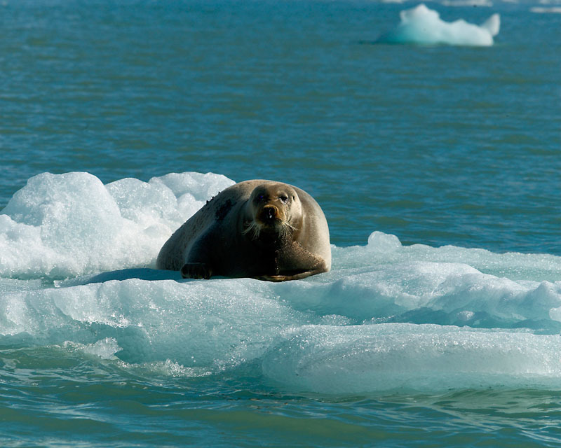
Bearded seal on ice, Spitsbergen, Norway © Wim van Passel / WWF-Canon

Bearded seal on ice, Spitsbergen, Norway
© Wim van Passel / WWF-Canon


Anybody can make choices when they have all of the information, especially if all of the information leads to one inescapable conclusion. It’s a lot harder to make choices when you only have part of the information, and must wait many years to see if the information was exactly correct. That is the position that faces policy makers now in the Arctic, as they make choices based on the disappearing sea ice.
We know the ice is shrinking – that has been clearly demonstrated by satellite monitoring over the past few years. We do not know exactly what that means for Arctic life.  A new report from the Arctic Council lays out what we know and what we don’t know about the effects of the ice shrinkage. “Life Linked to Ice” talks about the direct and indirect changes that Arctic species face as the ice shrinks. For species such as polar bears, it is clear that their preferred hunting grounds will be less available. Other effects are not so easily visible, but may be just as drastic. The change in light and temperature with the loss of sea ice encourages different species of the smallest life in the ocean. As those species change, the species that feed on them may change, affecting the whole system.
As the report concludes, “To what extent Arctic species will adjust to these changes is uncertain. Changes are too rapid for evolutionary adaptation, so species with inborn capacity to adjust their physiology or behavior will fare better. Species with limited distributions, specialized feeding or breeding requirements, and/or high reliance on sea ice for part of their life cycle are particularly vulnerable.”
Despite the uncertainty, there are choices that could or should be made. As WWF points out in the report, waiting until we know as much as we’d like may be too late for any effective actions to be taken. This is particularly true of managing areas for conservation. Creating a park or other protected area can take decades. Arctic governments and peoples need to immediately take a close look at this report and its recommendations. There is one recommendation that is not in the report, but should be, and it’s simple: act now.

Losing an icy friend

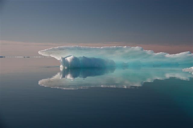
Iceberg encountered on a voyage through the Northwest Passage on the ship Silent Sound, Summer 2009. © Cameron Dueck / WWF

Iceberg encountered on a voyage through the Northwest Passage on the ship Silent Sound, Summer 2009. © Cameron Dueck / WWF


As we hit the annual Arctic summer sea ice low, WWF’s Samantha Smith reflects on her years spent in the Arctic, and the lives and cultures we are losing with the ice.
Watching climate change eat away at the Arctic sea ice is like watching a best friend waste away. I have nearly overwhelming feelings of sadness, resignation and even anger at how we could have let this happen – how we continue to let this happen.
I worked for WWF in the Arctic for more than ten years, out in the field with reindeer herders, with scientists in ships by the ice edge and in meeting rooms with ministers. For all of those people, a constant preoccupation is the state of the Arctic’s snow and ice. Ice is the defining characteristic of the high north all year round. Sea ice is the home, maternity ward, and feeding place of the Arctic life we can see, the seals, walrus and polar bears. What we do not see is the springtime melt, when plankton under the ice is released by the melt in a cascade of food, bringing the icy seas to life for fish and seabirds and whales, powering and animating the whole Arctic food web.
This life gives life to the peoples of the Arctic, giving them healthy local food. The sea ice also functions as a road connecting the far-flung communities of the north. These roads are now becoming treacherous, and people are nervous, even fearful of routes used for generations. And there is talk now of ships soon being able to sail through the Arctic during summers.
While I spend no time in the Arctic now, it’s never far from my thoughts. I will always remember the warmth and hospitality of northern communities, the beauty of a single pure white ivory gull; three young walrus popping out of  the water with eyes even wider than my own, a polar bear mom and her fuzzy cub suddenly appearing as we scrambled away to give them space.
This is a world that had essentially changed very little in human history. Now each year, scientists measure how much Arctic sea ice is left. Last year it hit a dramatic new low; today, at the end of the Arctic summer, it is still low and getting ever thinner. People who study the relation between climate and sea ice say that the Arctic has entered a new state, one that may be hard to halt.
The worst part is that we could have done much more to prevent this.  A decade ago, I was part of the Arctic Climate Impact Assessment (ACIA). It was the first full-scale review of what climate was doing and was likely to do to the Arctic. Scientists told us then that we must phase out the use of coal, oil and gas, or expect sea ice to melt away.  Looking back, the most frightening thing is the extraordinary decline that has occurred already since the turn of the century. We didn’t listen, we didn’t act and now we are seeing the consequences.
I have a new job now in WWF: I lead our global work on climate and energy. My dream of saving the Arctic is the same, but now I’m doing it by fighting climate change. And to fight climate change, we have to move immediately and on a global scale away from dirty fossil fuels, the single biggest source of the CO2 pollution that is melting sea ice, and to clean and safe renewable energy.
This year, WWF and many other organizations are campaigning to get banks, governments and pension funds to put their money into renewables and take it out of fossil fuels. We want at least US$40 billion in new investments for renewable energy and commitments not to invest in new coal, oil and gas projects. We know this is just a start, but we also know that we have to start now.
Moving investment is one of the most concrete things we can do. Some Arctic countries are beginning to understand this:  the United States, Norway, Sweden, Iceland, Denmark and Finland have all committed to virtually end overseas public funding to coal power . This is making me hopeful, and I hope to see more.
While the Arctic feels far away to many, the solutions to keeping it in something like its present state couldn’t be closer to home. We can all take responsibility to ask our pension funds, our banks and our governments to take this lead.
I’m hoping the anger and sadness I feel at the loss of the sea ice will melt away in the coming years, thawed by the actions of people and governments to stop the ice decline, and to take best care of the ice that remains.

Northeast Passage: ICE!!!

This summer, WWF is helping support two expeditions that will take on some of the world’s most difficult waters, to see first-hand the effects of Arctic climate change. One expedition is sailing across the top of Russia, a journey of 6000 nautical miles through the Northeast Passage, while another is attempting a west to east transit of the Northwest Passage, also by sailing boat, a journey of about 7,000 nautical miles.
Tom Arnbom of Sweden was on the ‘Explorer of Sweden’ though the Northeast Passage, as was WWF Arctic Programme Director Neil Hamilton for much of the trip, replaced near the end by WWF polar bear coordinator Geoff York. On the ‘Silent Sound’ Cameron Dueck of the Open Passage Expedition is filing regular stories from the Northwest passage. Come back for photos and stories throughout the summer, and follow the progress of the boats as they follow in the wake of some of history’s most intrepid explorers.
By Neil Hamilton
We have experienced our first encounter with drifting sea ice, at last, almost 2 weeks after leaving Murmansk.
I came on watch at midnight with a calm sea and wind so we were motoring along. About 1am the wind picked up and we decided to put up the sails.  It was great to be sailing again!  However within 10 minutes I saw something that looked like a yacht on the horizon, sailing towards us.  Unlikely given where we are: there is only one boat within 100km of us!
The ‘yacht’ turned out to be the advance guard of a fleet of icebergs that soon surrounded us. For about an hour the sea was full of pieces of white, brown, and green fragments, some a metre across, some hundreds of metres. The water temperature dropped from 4 degrees to 1.8 in half an hour.
Then they were gone, and only the occasional piece floated past by the end of my watch at 4am.  But this signals the next phase of the expedition when we need constant vigilance: one hit could create a situation we certainly don’t want.
So where does this ice come from?  We have been monitoring a stream of ice moving south from the main polar ‘cap’, down the west coast of Severnaya Zemlya.  It has been slowly breaking up over the last week, and moving west.  There is also ice that has been attached to the islands of several archipelagos in the region that is breaking up and moving with the wind and currents.  Some of the ice we saw tonight was very dirty, often an indication that it has been very near land.
The fact we are seeing ice now is not unusual: at 76 degrees North the sea has typically been frozen for most of the year.  The fact we have got so far already is in itself a feat.  From now on our progress will be determined not by the ‘big picture’ melting of the arctic ocean, but by the vagaries of the weather and drift patterns of ice around and between the islands near Cape Chelyuskin.
[iframe http://www.sat2twitter.com/map/generate/ntmhamilton 580 380]