Tag Archives: oceans

A resilient ring around the Arctic

WWF’s Arctic conservation director, Martin Sommerkorn, tells a story of his meeting with a Greenlandic fisherman. The fisherman is increasingly finding a new type of fish more common to warmer waters, for which there’s no name in Greenlandic. But it’s big, and it’s a reliable source of food – he wouldn’t mind catching more of them in the future.
Change is inevitable, particularly in the Arctic, which is warming at twice the rate of the world. Managing change doesn’t mean a return to stasis, but ensuring that the resources that Arctic people and wildlife depend upon persist.
But how do you plan for the future when you don’t know exactly what’s coming? One way is to ensure that you have options – that you preserve as wide a swathe of the Arctic’s biodiversity as possible, in the places most resilient to change, and most valuable to people and wildlife. This could look like a network of marine protected areas (MPAs) spanning the Arctic’s seas. Here at the Arctic Circle conference in Reykjavik, some of the world’s experts on Arctic MPAs are talking about what’s needed to make that a reality.
The traditional model of protected areas, of terrestrial parks with clearly defined boundaries, is unlikely to be sufficient in the Arctic. The most biologically productive areas shift over the year, and over the decades, with the sea ice edge. A shipping route may be vital whale habitat in June, and quiet in January.
MPAs in the Arctic must therefore be flexible, but they must also take into account an updated definition of “value”. Economic value of resources is only one measure. The value of a healthy narwhal population, or opportunities for an Arctic community, or carbon storage, is harder to quantify, but just as important. The MPAs should also have options for sustainable development, and should build the capacity of Arctic people to adapt to change.
It’s a novel model, and the MPA network is only in its infancy today. 11% of the Arctic is protected, but very little of that area is marine.
How do we get to an Arctic ring of resilience? Some of the foundational work is already done. The RACER project, developed by WWF, quickly identifies resilient and valuable places. Now it is up to Arctic nations to begin adding to their section of the ‘ring’, based on RACER results and further research as needed.
The Arctic of the future may look different from the one we’re used to, but new approaches to conservation can ensure it remains a living Arctic.

U.S. action needed on ocean acidification

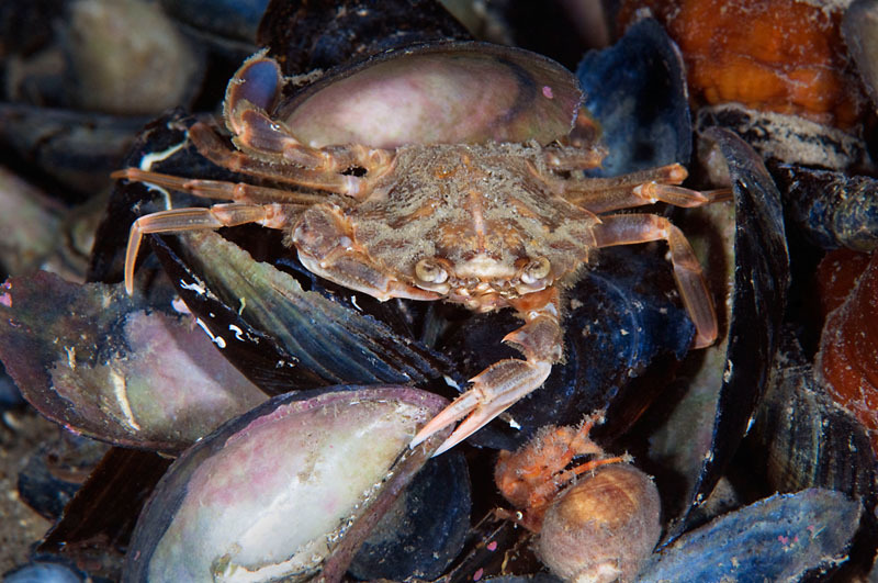
Harbour crab, Lofoten, Norway. © Wild Wonders of Europe /Magnus Lundgren / WWF

Harbour crab, Lofoten, Norway. © Wild Wonders of Europe /Magnus Lundgren / WWF


Dr. Thomas Armstrong is the Deputy Secretary of the Arctic Monitoring and Assessment Programme and leads the Adaptation Actions for a Changing Arctic. He previously served in the Obama Whitehouse as the Executive Director of the U.S.Global Change Reaserch Program. This article originally appeared in The Circle 01.15.
The ocean regulates our climate and our weather and plays a fundamental role in maintaining Earth’s water, carbon and nutrient cycles. Since the start of the Industrial Revolution, human activities have upset the natural balance of nutrients in the ocean. Tom Armstrong warns changes in the oceanic carbon cycle are causing dramatic changes in the Arctic Ocean and need a strong response from the incoming chair of the Arctic Council.
The ocean has absorbed nearly one-third of the carbon dioxide (CO2) added to the atmosphere by humans from deforestation and the burning of fossil fuels. Because the ocean has absorbed so much CO2, greenhouse warming of the atmosphere is less severe. But, there is a critical downside: the dissolved CO2 increases the acidity of ocean water, threatening aquatic life and the livelihoods that depend on it. Without global action to limit CO2 emissions, this trend will continue.
Ocean acidification is a big issue for the Arctic, where relatively shallow water depths and significantly large CO2 influx from both human and natural sources can result in acidic waters, leading to substantial impacts on a very vulnerable food web. Exacerbating the problem is the fact that the relatively cold waters of the Arctic allow CO2 to be absorbed more easily than in warmer tropical waters, amplifying the acidifying effect of atmospheric CO2 at polar latitudes. In addition, as ice melts in the Arctic, the seawater becomes less salty, and less salty water absorbs CO2 more efficiently. Yet with all of these potentially significant impacts and related consequences, acidification of the Arctic Ocean is poorly understood, under-observed and under-researched. Continued anthropogenic climate change and increasing amounts of carbon uptake by the Arctic Ocean are likely to have significant detrimental impacts on the physical, biological, social and economic state of today’s, and especially tomorrow’s, Arctic communities.

Acidification of the Arctic Ocean is poorly understood, under-observed and under-researched.

What we Already Know
The Intergovernmental Panel on Climate Change (IPCC) 5th Assessment Report included several important findings with relevance to both global ocean health and acidification of the Arctic Ocean, including:

  • Ocean warming dominates the increase in energy stored in the climate system, accounting for more than 90% of the energy accumulated between 1971 and 2010 (60% above 700m, 30% below 700m)
  • Ocean acidity has increased approximately 30 percent since the Industrial Revolution
  • More acidic oceans will have broad and significant impacts on marine ecosystems, the services they provide, and the coastal economies, which depend on them
  • Oceanic uptake of anthropogenic CO2 will continue under all future emission scenarios, however, uptake is greater for higher concentration pathways – causing even more acidification, with carbon cycle feedbacks that will exacerbate climate change

The U.S. Perspective
U.S. federal agencies are currently conducting research, implementing policies and developing measures to better understand and address the effects of ocean acidification. But more is needed. We believe the U.S. must continue to lead the charge for the international community to increase international collaboration on ocean acidification research in the Arctic, particularly with regard to the effects of acidification on shell-forming organisms, marine biodiversity and food security.
Ocean acidification was one of the three topics that Secretary John Kerry chose to highlight in the Our Ocean conference. The Our Ocean Action Plan, released by Secretary Kerry during the conference, identified the importance of reducing CO2 emissions to stem the increase in ocean acidification and the need to create worldwide capability to monitor ocean acidification.
The U.S. continues to promote the development and establishment of the Global Ocean Acidification Observing Network (GOA-ON), which will measure ocean acidification through the deployment of instruments in key ocean areas. This is a new network with broad international cooperation and a commitment to build capacity in developing countries. Since 2012, the United States hasprovided financial support, totaling approximately $1 million, and related in-kind support for the establishment of a new Ocean Acidification International Coordination Center (OAICC) based in Monaco, which will help facilitate global cooperation to advance our understanding of ocean acidification.

Recommendations for Action by the Arctic Council
During its 2015 to 2017 Chairmanship of the Arctic Council, the U.S. should take a leadership role in:

  • Promoting the development of a full-scale, rigorous assessment of Arctic Ocean acidification by the Arctic Monitoring and Assessment Programme’s (AMAP) Arctic Ocean Acidification Expert Group.
  • Continuing to support efforts like Global Ocean Acidification Observing Network through monetary and expertise contributions.
  • Developing a communications and outreach strategy aimed at raising awareness of Arctic Ocean acidification (OA) as an issue that impacts the globe- not just the Arctic
  • Developing a focused mechanism for directly connecting the U.S. OA Interagency Working Group (IWG) with states, NGOs, foundations, academia, local communities and private industry – within the U.S. and across the Arctic Council countries to share best practices and lessons learned in addressing the causes of and impacts from OA.
  • Developing strategies for raising the profile of OA—and Arctic Council-led solutions—in upcoming UN Framework Convention on Climate Change (UNFCCC) COPs
  • Developing strategies/efforts for raising the profile and scientific expertise capacity of OA within the more mainstream Arctic Council climate change efforts, such as AMAP’s assessments and monitoring activities.
  • Utilizing the circum-Arctic countries’ leadership elements within AMAP and Sustaining Arctic Ocean Observing Networks (SAON) to find creative ways to help fund standardized OA monitoring instruments across international borders and leverage existing and planned activities across borders
  • Organizing a roundtable discussion with leading industry players, NGO and/or philanthropic leaders with a focus on determining the requisite science and monitoring assets needed to better understand past, present and future trends of OA as well as the resultant impacts and effects
  • Proposing oil and gas companies with offshore oil platforms in the Arctic add monitoring devices to their installations
A regional seas approach for the Arctic: what does it mean?

Photo: naturepl.com / Andy Rouse / WWF


BROOKS YEAGER has considerable experience with issues in the U.S. and Circumpolar Arctic including: Deputy Assistant Secretary for Environment and Development at State; lead U.S. negotiator for the 2001 Stockholm Convention on Persistent Organic Pollutants; Deputy Assistant Secretary for Policy and International Affairs at the Interior Department. He also worked with the State Department on the establishment of the Arctic Council. This article originally appeared in The Circle 01.15.
As part of a wide-ranging and ambitious agenda for its upcoming chairmanship of the Arctic Council, the US has expressed its interest in moving towards a regional seas approach to improve stewardship and governance of the Arctic marine environment.   What this means has not yet been fully detailed by U.S. officials, although as Brooks Yeager writes, enough has been said that we may make some educated guesses.  
The regional seas approach has its roots in Regional Seas Agreements, which are cooperative intergovernmental frameworks for ocean management and conservation in various areas of the world’s oceans. A number of such agreements, or RSAs, have been formed under the auspices of the United Nations Environment Program (UNEP), while others are essentially autonomous regional associations based in the sovereign authority of their member governments.
Although RSAs are by their nature frameworks, often crafted with enough flexibility to evolve over time, they frequently have specific aims with respect to which their member governments organize their efforts.
Notable among existing RSAs are: OSPAR, the Convention for the Protection of the Marine Environment of the North-East Atlantic which seeks to conserve and prevent pollution in the NE Atlantic; HELCOM, the Baltic marine Environment Protection Commission which aims to restore and protect the environment of the Baltic Sea; and the Black Sea Convention, which seeks to maintain the health of the Black Sea ecosystem.   There are, of course, many more RSAs, including in the Mediterranean, the Caribbean, the Eastern Pacific, and even for the Caspian Sea.

Although the U.S. was historically a reluctant partner in the initial formation of the Council, the Council’s utility as a forum for discussing Arctic policy matters, and the success of its working groups has caught the attention of successive U.S. administrations.

What would be the primary purpose of an Arctic RSA, should one be established? Of course, this would be subject to negotiation among the Arctic governments. However, State Department officials have dropped some hints relating to US objectives. One of the three principal pillars of the US chairmanship is “strengthening stewardship and management of the Arctic marine environment.”
An RSA oriented to such a goal might be expected to emphasize cooperation in science and monitoring, as well as management techniques such as ecosystem-based management (EBM) and the conservation of valuable and vulnerable marine habitat.
At the same time, Admiral Robert Papp, the new US Special Envoy for the Arctic, has made it clear that there is also an interest in maintaining and advancing practical cooperation on maritime safety and navigational issues, including pursuing coordinated implementation of the existing agreements on search and rescue (SAR) and oil spill preparedness and response (OPPR). It seems likely, therefore, that an Arctic RSA would have such a practical orientation at its core.
The question of the appropriate membership of an Arctic RSA is an interesting one. Although one could imagine such an RSA including only the Arctic littoral states, i.e. Canada, Denmark (for Greenland), Norway, Russia and the U.S., U.S. officials have made it clear that they would seek to include all eight Arctic governments, as well as the so-called “Permanent Participants,” the representatives of the Arctic’s Indigenous peoples. In part, this preference reflects strong U.S. support for the existing Council, as the appropriate forum for the coordination of policy and management approaches in the region. Although the U.S. was historically a reluctant partner in the initial formation of the Council, the Council’s utility as a forum for discussing Arctic policy matters, and the success of its working groups over twenty years in framing significant problems for resolution has caught the attention of successive US administrations. The result is that strengthening the Council has now become a significant priority for the U.S. chairmanship agenda.
Whether the specific potential benefits of an RSA that the U.S. conceives can actually be brought to fruition depends on the reaction of the other seven Arctic Council nations, the Permanent Participants and the broader community of institutions and organizations who concern themselves with development and conservation issues in the Arctic region.  There have already been some encouraging signs, in terms of the responses of the Senior Arctic Officials in the recent Yellowknife meeting, and of various interested groups, including the informal Ecosystem-Based Management Expert Panel, which endorsed the regional seas approach at its recent meeting in Trondheim. The EBM panel, in particular, pointed out that an Arctic Regional Seas Agreement would be a useful framework in which to share experiences and methodologies and to improve coordination of implementation of the ecosystem approach to management of the Arctic marine environment.
 

Protecting areas beyond national jurisdiction

Sea ice cover in spring is something we track very closely, as we cannot cross the Labrador Sea and Davis Strait, or get to remote northern communities, until the sea ice has melted or broken out. During the summer we constantly monitor ice charts to keep track on drifting pack ice and areas with a high density of icebergs. Ice is obviously a constant risk in the north that governs every decision.

Students on Ice / WWF


This article is reprinted from The Circle 4.14. Kamrul Hossain is a Senior Research Scientist, Northern Institute for Environmental and Minority Law Arctic Centre, University of Lapland
The Arctic is dominated by a marine area that is equal in size to continental Africa and is surrounded by the landmass of six countries. The primary international legal framework applicable to the Arctic is the United Nations Convention on Law of the Sea (UNCLOS), although it has not been ratified by the United States. The high seas and the ocean floor beyond continental shelves together form what is defined in the Convention as Areas Beyond National Jurisdiction (ABNJs). The states party to the Convention enjoy a set of rights in such areas, including exploitation of marine resources. They also have an obligation to conserve marine biodiversity. However, this obligation is general in nature and not underpinned by any clear protection mechanism.

Given the sensitive and fragile nature of the Arctic ecosystem, the Arctic Ocean can be regarded as an ecologically and biologically significant area (EBSA), which requires a special protection regime.

The Arctic Ocean faces numerous changes and challenges. The consequences of climate change, rapidly melting sea ice, the emergence of new shipping routes, increased access to extractive resources and other possible commercial uses of the Arctic marine environment pose alarming risks, the likely effect of which will be destruction of the marine ecological balance. Given the sensitive and fragile nature of the Arctic ecosystem, the Arctic Ocean can be regarded as an ecologically and biologically significant area (EBSA), which requires a special protection regime. Even though the concept of EBSAs is endorsed within the Convention on Biological Diversity (CBD) regime, it has yet to offer any concrete tool for the conservation of marine biodiversity. The CBD nevertheless endorses the concept of Marine Protected Areas (MPAs), one of the objectives of which is to protect marine biodiversity. Consequently, the UNCLOS obligations concerning the preservation of marine biodiversity are complemented by the CBD. While it has been argued that UNCLOS provides a legal basis for the creation of MPAs under the general obligation set forth in article 192 in combination with article 194(5), it is not unequivocally clear whether MPAs can be established in an area beyond national jurisdiction. The general view is that an MPA can be established within an Exclusive Economic Zone, over which the coastal state has the authority to extend national regulations.
However, the Conference of the Parties to the Convention on Biological Diversity has addressed the issue of MPAs in an ABNJ on a number of occasions. At the present, setting up MPAs in an ABNJ has taken place under the auspices of the regional sea organisations. Unlike some other sea areas, the Arctic Ocean does not have any such body – despite the coastal states’ on-going process of cohesion since the 2008 Ilulissat meeting. The Convention for the Protection of the Marine Environment of the North-East Atlantic has established a regional sea organisation that covers part of the Arctic Ocean. The Convention provides a comprehensive legal framework for implementation of Part XII (Marine Environmental Protection) of the UNCLOS in line with the objective of the CBD, which covers a sizeable area beyond national jurisdiction. While Regional Fisheries Management Organizations (RFMO) play an important role in the conservation of fish stocks, the Arctic Ocean is, again, only partly covered – by the North East Atlantic Fisheries Commission. There is no Arctic-wide organization.
The International Maritime Organization (IMO) has established special protective measures in defined areas – both within and beyond areas of national jurisdiction – where shipping presents a risk of impacts on marine biodiversity. The International Convention for the Prevention of Pollution from Ships, adopted under the auspices of the IMO, designates Special Areas, in which maritime activities are closely regulated. The process of designating a Special Area has been further supplemented by the guiding concept of Particularly Sensitive Sea Areas (PSSA), areas requiring special protection because of recognised ecological, socioeconomic or scientific attributes that may be vulnerable to damage by international shipping activities. Whereas to date the IMO has not designated any PSSAs in an ABNJ, the ecological and biological importance of the central Arctic Ocean make it particularly sensitive as a site of marine biodiversity. The International Whaling Commission, an international body set up by the International Convention for the Regulation of Whaling, has established whale sanctuaries in which whaling is strictly prohibited. These may in principle be set up in the Arctic Ocean. Nevertheless, neither PSSAs nor whale sanctuaries constitute MPAs, as they would not comprehensively regulate human activities that potentially interfere with the marine environment.
The principal legal actor in the Arctic is the Arctic Council, an organisation whose membership includes all eight Arctic states. Under the Council’s auspices and through the contribution of its working groups, the states have adopted a number of instruments relevant to the protection of marine biodiversity. While such instruments are typically not legally binding, today the Council serves as the venue to negotiate binding agreement. One record that merits mention is the 2013 Agreement on Cooperation on Marine Oil Pollution Preparedness and Response, which seeks to minimise risks from oil pollution at sea. Among the Council’s other contributions, two working groups – the Conservation of Arctic Flora and Fauna (CAFF) and the Sustainable Development Working Group (SDWG) – have recently produced the Arctic Biodiversity Assessment report and the Best Practices in Ecosystems-Based Ocean Management report, both of which are useful for fisheries conservation and management, among other purposes. Two other working groups – the Protection of Arctic Marine Environment (PAME), the Emergency Preparedness, Prevention and Response (EPPR), the Arctic Monitoring and Assessment Programme (AMAP) – together with CAFF, played a significant part in the states adopting the Arctic Offshore Oil and Gas Guidelines with a view to protecting the Arctic marine environment from unwanted environmental effects caused by offshore oil and gas activities.
The protection regime for Arctic marine biodiversity entails certain legal limitations. The designation of EBSAs does not yet have any concrete legal basis and the concept of a PSSA developed by the IMO is not a legally binding principle. Moreover, despite the fact that the UN Fish Stock Agreement is applicable to the Arctic Ocean, its scope is limited to highly migratory and straddling fish stocks; in addition, the lack of an Arctic-wide RFMO limits the protection of fish stocks occurring in the high seas. What is more, the absence of any defined legal framework for RFMOs makes it impossible to adopt concrete conservation measures, such as the establishment of Marine Protected Areas. The Arctic Council, despite its valuable contribution in producing assessment reports, has not to date focused on the conservation and management of targeted species as living resources. It does not have any working group, for example, on fisheries issues and, significantly, it may only set non-binding obligations.
Overall, the Arctic Ocean lacks a clear legal framework for comprehensive regulation of human activities that may compromise marine biodiversity in an Area Beyond National Jurisdiction. While a network of MPAs in the ABNJs of the Arctic Ocean could be an appropriate legal tool, the pertinent problem is the likely tension with regard to the rights and interests of the third states—those states that are not parties to the respective MPAs but have other rights granted under the Law of the Sea Convention within the MPAs.
Therefore, it is important to have consensus-based, multi-purpose MPAs that include actors from both inside and outside the Arctic who cooperate in negotiating comprehensive legal arrangements. The Arctic Council could take the lead here, given recent developments, such as the UN General Assembly’s initiative for a legal framework for sustainable use of marine biodiversity beyond areas of national jurisdiction. The UN proposal covers various aspects of marine biodiversity management in what has been termed the package approach.

Protecting “the great upwelling”

This article is reprinted from The Circle 4.14.  Parnuna Egede is the Advisor on Environmental Issues for the Inuit Circumpolar Council- Greenland.
The North Water polynya in Baffin Bay is a huge stretch of open water surrounded by ice between Canada and Greenland. This key wintering area attracts abundant numbers of marine mammals such as polar bears and narwhals and numerous seabirds. The mixing of water currents originating from the Atlantic and Pacific causes the upwelling of nutrients to the surface. This triggers plankton blooms, which in turn boost the rest of the food web. Inuit communities are calling for a commission to consult on the protection and future use of this extraordinarily productive polynya.
What makes this polynya one of the most biologically productive in the Arctic is the formation of an ice bridge in Kane Basin north of the polynya. It blocks the otherwise constant flow of sea ice from the Arctic Ocean. When the ice bridge is absent, productivity is much lower. But formation of this ice bridge occurs less frequently now due to climate change.
The ice bridge is not only important biologically, but also historically. It served as an actual bridge for the earliest immigration and settlement of human populations from North America to Greenland beginning in 2500 B.C. up until the middle of the 20th century. This rich biological habitat still sustains Inuit communities on both sides of the bay. It is no coincidence that the Greenlandic name for the North Water polynya is Pikialasorsuaq – “the great upwelling”.
Bridging the Bay
Acknowledgement of the critical importance of Pikialasorsuaq to the Inuit was the impetus for a workshop organized by the Inuit Circumpolar Council – Greenland and co-sponsored by Oceans North Canada on “Pikialasorsuaq – Bridging the Bay” in Nuuk in September, 2013. Over twenty participants attended the two-day workshop.
Inuit hunters and fishermen from communities surrounding the North Water polynya—Pond  Inlet, Grise Fiord and Arctic Bay in Nunavut, and Kullorsuaq and Qaanaaq in Greenland—shared their observations on changes in sea ice and snow conditions as well as distribution and behaviour of marine mammals. Scientists from both countries also presented their current understanding of the geology, oceanography, biology and history of this region.
This dialogue served as a basis for the discussion on potential uses and non-uses of the polynya. For example, KNAPK, The Organization of Fishermen and Hunters in Greenland advise halting seismic activities and hydrocarbon exploration offshore of Northwest Greenland. They are concerned about potential harmful effects of these activities on fishing and hunting as well as the environment, and the lack of proper compensation to fishermen and hunters for adverse effects.
The workshop succeeded in “bridging the bay”, creating a strong consensus to explore joint strategies for safeguarding and monitoring the health of this region for future generations. One significant outcome was agreement to work towards creating a joint commission mandated to consult with local communities about the future use and protection of the area.

The ice bridge is not only important biologically, but also historically. It served as an actual bridge for the earliest immigration and settlement of human populations.

Shortcomings of the international process
The input gained from the Pikialasorsuaq workshop was then shared by ICC-Greenland at the Arctic regional workshop to facilitate the description of Ecologically or Biologically Significant Areas (EBSA). This workshop was organized by the Convention on Biological Diversity (CBD) in Helsinki in March, 2014. ICC-Greenland was invited in its capacity as a Permanent Participant of the Arctic Council.
Supported by social and cultural criteria, ICC-Greenland submitted the North Water polynya as a cross-border area fulfilling the criteria of an EBSA. But despite the fact that participating Canadian and Greenlandic/Danish scientists agreed to the importance of the polynya, it was not possible to include it as an EBSA at this level.
The reason seemed to be political reluctance to submit an area that spans national Economic Exclusive Zones for consideration. Since the EBSA process is a national process, it became evident that it falls short when it comes to:

  • scientific coordination between states when EBSA are cross-border in nature
  • incorporation of input from cross-border Indigenous Peoples’ Organizations
  • social and cultural criteria, including significance for Indigenous Peoples

Added value of a commission
In the international process only states can put options on the table and take decisions. ICC-Greenland could only have its submission included in the report as an example of challenges to incorporate indigenous input in the EBSA process. To acknowledge the importance of the North Water polynya in the CBD, Canada and Greenland will have to submit their halves of the polynya into the CBD repository – And hope that the two pieces of the puzzle fits together.
ICC-Greenland believes that a joint commission between Canada and Greenland is the best way to ensure full and active participation of Inuit on both sides of the North Water polynya. The collective input from Inuit will add value along with scientific coordination when working towards gaining EBSA status to the polynya. This will help any conservation efforts strike a proper balance between the socially and culturally important subsistence hunting and the need to protect the habitat for generations to come.

Culturally significant places: answering the where

This article is reprinted from The Circle 4.14. Maryann Fidel is the CONAS Project Manager at the Aleut International Association, a permanent participant of the Arctic Council. She works with rural Bering Sea communities in Alaska and the Russian Far East on a community-based observation and monitoring network.
People living in remote subsistence-based communities know very intimately the places that are important to the well-being of their village.  It is the beach where their grandpa taught them the seasonal patterns of the seal, or a family’s salmon camp that has been there as long as anyone can remember.  There is a critical need to translate this knowledge into something that can be used to inform decisions.

It is important to fill in gaps in knowledge so that important sites or activities are not neglected through ignorance.’

When creating maps of harvest areas it is essential that local people are meaningfully engaged in the design of the study, data collection and presentation. Maps often contain sensitive information and are frequently created to address issues that affect the community. Identifying marine areas important for traditional hunting and fishing are crucial for minimizing conflicts between coastal communities and marine-based industries, which are expected to increase in the Arctic.  This has been recognized at the international level with the Arctic Council’s publication, The Arctic Marine Shipping Assessment 2009.
Two recommendations from this report address the need to identify areas used by Arctic communities, as well as areas of cultural significance. As a follow up to these recommendations a report entitled ‘Identification of Arctic marine areas of heightened ecological and cultural significance’ attempted to identify areas of particular ecological and cultural importance in 2013.  The short chapter that examines areas of cultural significance concludes ‘available information makes the extent of this cultural legacy clear, but details are lacking. It is important to fill in gaps in knowledge so that important sites or activities are not neglected through ignorance.’
The Aleut International Association (AIA)—a permanent participant in the Arctic Council—has taken an active role in the mapping of culturally significant areas.
The Bering Sea Sub-Network (BSSN) was an international, community-based observing network that began in 2007 and ran until 2014.  It was a partnership involving AIA, the University of Alaska Anchorage, the Alaska Native Science Commission and 8 indigenous, subsistence-based communities in Chukotka and Kamchatka in the Russian Federation, and Alaska, USA. This project brought together people from a variety of different backgrounds and cultures who share a dependence on the health of the Bering Sea.
One aspect of the research included a mapping effort to characterize where people harvested important subsistence species.  Surveys were administered by local Community Research Assistants to the same respondent pool of high harvesters every six months over a four year period.  During the interview hunters and fishers were asked to circle on a map where they had gone to harvest select species during the past six month period.  These methods were based on the idea that harvest areas are dynamic, people go to different places depending on the time of year and depending on environmental conditions such as storms, animal migration patterns, etc.  A single map of a subsistence harvest, while useful, is unable to capture this dynamic reality.  These techniques helped to not only answer the question of where people go to harvest, but when.  An innovative mapping methodology was developed to protect the confidentiality of individual harvest areas, incorporate large amounts of spatial information, and present use areas on a gradient scale (from high to low use).
The following map demonstrates change over time.   This particular change is likely due to a convergence of factors including: a change in the range and availability of species; climatic change; a complex regulatory structure; industry practices and/or socioeconomic factors.
walrus
The Community Observation Network for Arctic Subsistence (CONAS) is a new project initiated by the Aleut International Association and the University of Idaho which builds on BSSN.  It is continuing this dynamic subsistence mapping effort in Bering Sea communities.
AIA has also initiated a project within the Arctic Council’s Protection of the Arctic Marine Environment (PAME) working group called, ‘Arctic marine subsistence use mapping: Tools for communities’.  The goal of this project is to provide communities with the tools to produce high quality maps of locally important, sensitive or vulnerable areas.
It is important to keep in mind maps of harvest areas represent just one aspect of how Indigenous communities relate to the environment. They should be used in conjunction with, not instead of, community consultation.

The Sea of Okhotsk: a billion dollar ecosystem

This article is reprinted from The Circle 4.14. Dr. Eduard Shirkov is the head of Laboratory of Environmental Economics Research, Kamchatka Branch of the Pacific Institute of Geography.
The Sea of Okhotsk boasts an area of roughly 1.6 million square kilometers, water volume of more than 1300 cubic kilometers, and a coastline over 10 thousand kilometers long. The average depth of this remarkable body of water ranges from 820 meters, to a maximum depth of 3916 meters. In terms of natural resources, these features combine to make the Sea of Okhotsk one of the largest and richest shelf seas in the world.  Worth billions of dollars in ecosystem services, and critically important to human life,  it needs and merits protection from over-exploitation.

The natural resources potential of the Sea of Okhotsk is both a unique and considerable piece of the natural capital of Russia.

The waters of the Sea of Okhotsk create their own unique water masses due to the varying widths and depths of the Kuril Islands, which border the sea. Because of the high differentiation of hydrological factors and climate, a full water exchange between the Sea of Okhotsk and the ocean requires many years, creating unique ecosystems with very high biodiversity. The northern parts of the Sea predominantly contain ecosystems with Arctic species of flora and fauna, while the rest of the Sea feature boreal ecosystems.
The natural resources potential (NRP) of the Sea of Okhotsk is both a unique and considerable piece of the natural capital of Russia. It accounts for more than half of the far-eastern and nearly one quarter of all Russian fish catches. Due to its tidal sea influx, it is also an area of huge hydroenergy potential, again, unique in its scale, and a significant source on a national scale of expected hydrocarbon resources. In addition, the largely undisturbed ecosystems of the Sea of Okhotsk provide a stable generation of ecosystem services, critically important for human beings. But paramount to all of these benefits generated by the Sea of Okhotsk are the provisioning services derived from exploitation of bioresources, and its regulating effect through carbon sequestration and assimilation of other industrial and agricultural pollutants.
circle
It should be noted, however, that the Sea of Okhotsk is the coldest of the Russian Far Eastern seas. The cold period (when the average daily temperature is below zero) lasts from 120 days in the south to 220 days in the north. A larger part of the Sea is covered with ice for up to 7 months annually. In January, the temperatures drop to minus 20-25 °C. Severe and frequent storms, icing factor, the lack of natural shelters for ships, as well as the high seismicity of the area pose serious risks for navigation and operation of offshore engineering facilities.
The maximal and stable level of the economic rent being held from NRP exploitation over a long time period can be taken as the main criterion of environmental and economic efficiency of natural resources management in a specific, ecologically isolated region. In the course of complex estimation of NRP elements of the Sea of Okhotsk, carried out by the scientists of the Kamchatka Branch of the Pacific Institute of Geography, the capitalized rent value of natural capital of the region is estimated at 454 billion US dollars. Extraction and utilization of all known Okhotsk hydrocarbons decrease this rent value by 134 billion US dollars. In addition, oil pollutants (without taking into consideration probable serious accidents) decrease NRP rent value that come from fish resources and relevant regulatory ecosystem services by another 39 billion US dollars”.
Modern technologies for offshore hydrocarbon exploration and transportation, and existing legal and economic mechanisms for nature management do not offset these decreases in value. Therefore the compromise solution for this conflict lies in the area of spatial specialization or zoning of marine nature management in the north-eastern and south-western parts of the Sea of Okhotsk, two areas which are different both in the structure of resource potential and conditions of their exploitation.
Zoning of the Sea of Okhotsk according to resource specialization of its areas can be done according to potential conflicts of parallel exploitation of marine bioresources and hydrocarbons; conditions of exploitation; and existing fishery zoning. Taking into account both factors, the boundary between resource-specialized zones can be drawn as an extension to the North-West of the existing boundary between fishing subzones 05.1 и 05.3 (Fig. 1). Two-thirds of the biological potential of the Sea of Okhotsk would then be concentrated in the north-eastern area—including the Western-Kamchatka shelf (Fig. 2). However, two-thirds of hydrocarbon potential would be concentrated in the south-western area (Fig. 3).
Potential losses of natural capital value caused by existing practices of nature management in the Sea of Okhotsk can be reduced by $93 billion through integrated marine management. Only through these measures will it be possible to conserve the highest bio-productivity of the north-western area of the Sea of Okhotsk, including the Western Kamchatka shelf, nominated as an Ecologically or Biologically Sensitive Marine Area under the Convention for Biological Diversity.

Protecting the Arctic marine environment – within and beyond national waters

This article is reprinted from The Circle 4.14. Dr. Nengye Liu is a Marie Curie Fellow at School of Law, University of Dundee, United Kingdom. His current research focuses on the European Union and the protection of marine biodiversity in the Arctic.
The Arctic is home to more than 21,000 known species of highly cold-adapted mammals, birds, fish, invertebrates, plants and fungi including lichens, plus tens of thousands of microbial species. But  climate change is inducing an ecosystem regime shift in some areas, resulting in a very different Arctic species composition.

Protected areas have been described by the Convention on Biological Diversity as an important means to achieve conservation gains.

Summer temperatures in the Arctic in recent decades have been warmer than at any time in the past 2000 years, with the region warming twice as fast as the rest of the planet. Arctic summer sea ice cover, particularly the amount of multi-year ice, is decreasing at an accelerating rate leading to increased human activities such as fishing, navigation and extractive industries within this fragile environment.
Protected areas have been described by the Convention on Biological Diversity (CBD) as an important means to achieve conservation gains. The IUCN defines a marine protected area (MPA) as: “any area of the intertidal or sub tidal terrain, together with its overlying water and associated flora, fauna, historical and cultural features which has been reserved by law or other effective means to protect part, or all, of the enclosed environment”. The Convention is in agreement that by 2020, at least 10 per cent of the world’s coastal and marine areas, especially areas of particular importance for biodiversity and ecosystem services, should be conserved through effectively and equitably managed, ecologically representative and well-connected systems of protected areas and other effective area-based conservation measures. As of 2010, 11 per cent of the Arctic, about 3.5 million km2, has protected status in 1127 protected areas. Over 40 per cent of Arctic protected areas have a coastal component but for the majority of these areas it is not possible to determine the extent to which they incorporate the adjacent marine environment. Therefore, the question is how to establish MPAs in the Arctic Ocean.
In 2008 in Bonn, Germany, the 9th meeting of the Conference Parties of the CBD (COP 9) adopted a set of seven scientific criteria to identify ecologically and biologically significant areas (EBSAs) in the global marine realm. These include:

  • Uniqueness or rarity
  • Special importance for life-history stages of species
  • Importance for threatened, endangered or declining species and/or habitats
  • Vulnerability, fragility, sensitivity, or slow recovery
  • Biological productivity
  • Biological diversity
  • Naturalness

In 2010, COP 10 noted that the application of the EBSA criteria is a scientific and technical exercise, that areas found to meet the criteria may require enhanced conservation and management measures, and that this can be achieved through a variety of means, including MPAs and impact assessments. A regional EBSA Workshop for the Arctic took place in Helsinki, Finland from 3-7 March 2014. The Workshop described 11 areas meeting the EBSA criteria, of which 9 areas were within the national jurisdiction of Russian Federation. According to United Nations Convention on the Law of the Sea (UNCLOS), waters within 370 kilometres (200 nautical miles) of shore make up exclusive economic zones (EEZs) of Arctic coastal states (US, Russia, Canada, Norway and Denmark/Greenland). Within EEZs, only coastal states are entitled to establish MPAs. One example is the U.S., which has adopted a closure of commercial fishing in its waters north of the Bering Strait until there is appropriate scientific understanding and management in place. The moratorium prohibits commercial fishing in all marine areas in the American EEZs of the Chukchi and Beaufort seas.
But beyond EEZs there are high seas in the Arctic Ocean. To date, there is no international legal regime that provides for cross-sector MPAs on the high seas. The lack of a regime addressing biodiversity in areas beyond national jurisdiction has already been identified by the international community and, during the UN Conference on Sustainable Development (Rio+20), states committed, on an urgent basis, to addressing the issue. The agreement to act included a commitment to taking a decision on the development of an international instrument under UNCLOS, before the end of the sixty-ninth session of the UN General Assembly to address biodiversity in areas beyond national jurisdiction. If the new implementing protocol of the UNCLOS can be adopted in the foreseeable future, it will provide a solid legal basis for the establishment of MPAs in the Arctic high seas, particularly in the central Arctic Ocean.

Finding the Arctic’s most important marine habitats

This article is reprinted from The Circle 4.14. Jake Rice is the Chief Scientist for Canada’s Dept. of Fisheries and Oceans, providing advice for international and domestic marine policy and management, including the EBSA process.

Developing scientific criteria for determining ecologically or biologically significant areas (EBSAs) was one of the key components of Canada’s plans to implement the Oceans Act in 1997. These criteria highlight waters that may have high functional significance for species that use the area; are fragile or highly vulnerable to perturbation; serve as centres of aggregation for populations; or are otherwise exceptionally diverse or productive. These criteria have since been applied to all of Canada’s marine areas and are proving to be of value in freshwater systems as well.
Initial meetings to apply the criteria in the more southern areas of Canada’s Atlantic and Pacific oceans relied primarily on extensive and spatially resolved sets of systematically-collected scientific data sets. When attention turned to the Beaufort Sea and Arctic Archipelago there were fewer such data sets, and their coverage was often limited in space and time. DFO turned to social scientists who worked with Elders and long-time residents of the Canadian North to record knowledge of areas of ecological or biological significance in ways that were culturally respectful and directly usable in the expert meetings for those two Arctic marine areas. The process for meeting and collecting this knowledge took time, but no more time than consolidating all the data sets of oceanographic and biological information in other areas. Some EBSAs were indeed recognized based on “scientific” data sets from remote sensing or ship-based surveys of ocean productivity, current patterns, and ice conditions, or by technologies for tracking tagged animals. Many others were identified based on Inuit and Aboriginal knowledge of migration routes of marine mammals and where they bred, fed, and overwintered, or areas where they have long fished or found seabirds. Often the available scientific data and knowledge of the Indigenous people worked in complementary ways to highlight the areas that were most significant on one or several of the criteria. Maps of all the EBSAs that have been identified are available here, along with rationales for each one.
The process of identifying the EBSAs focused on information-sharing and objectively using the knowledge from all sources to identify the areas that best reflected the pre-adopted criteria. The maps and justifications of EBSAs that were produced are rich in information. But maps are only maps until they are used as a resource for planning and management. This is where we are seeing concrete evidence that the time invested in creating them was time well spent.

Maps are only maps until they are used as a resource for planning and management.

First of all, in the process of applying the criteria, we learned some things about EBSAs that had not been grasped before. In the Arctic, many of the areas found to be ecologically or biologically significant got much of their significance from the position and nature of the ice front, which of course moves seasonally. For the first time, the meetings delineated EBSA boundaries that might have encompassed the entire area covered by the ice edge from its winter maximum to its summer minimum. But the justifications stress that within those larger boundaries, the features that made the area special would be found in association with the smaller subarea where the ice edge was located at any particular time. Importantly, the management implication of that situation was spelled out. In planning for activities that involve permanent built infrastructure, the entire area in the EBSA boundary needs to be considered as requiring particularly risk-averse management. In planning for activities which are inherently mobile, such as ecotourism or fishing, risk-averse management is still needed, but should be focused on the much smaller sub-area where the ice front is located at the time the activity is occurring. Since the Arctic EBSA workshops, this way of thinking about different kinds of EBSAs has spread to oceans all over the world, at is applies equally well to important features like oceanographic fronts.
So we now have these maps of EBSAs and their individual justifications. Are they making a difference? The short answer is that it is too soon to tell. Planning for uses and, where appropriate, protection of the Arctic is an ongoing process. Plans such as the Integrated Ocean Management Plan for the Beaufort Sea make extensive use of the results of the EBSA identification process in developing the plan. However that Plan is still fairly high level, implementing the concepts is another piece of work. What, if anything, ends up being different in the EBSAs versus other parts of the Arctic remains to be seen. Importantly though, the EBSAs are part of all the discussions for other topics such as Marine Protected Area networks in the Arctic, the routing of shipping, tourism etc. Having the information systematically available is already helping. As the EBSA identification process spreads to the rest of the Arctic, and as information accumulates and areas are reviewed, it can only get better.

Where the ocean blooms


© Wild Wonders of Europe /Magnus Lundgren / WWF

© Wild Wonders of Europe /Magnus Lundgren / WWF


This article is reprinted from The Circle 4.14. Dr. Jan-Gunnar Winther is a hydrologist and director of the Norwegian Polar. Dag Vongraven is a biologist and senior adviser at the Environmental and Mapping Department of the Norwegian Polar Institute. He also chairs the IUCN/SSC Polar Bear Specialist Group.
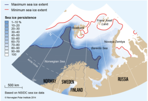
The ice edge is rarely a neat line. Rather, it comprises a dynamic zone of varying degrees of ice cover between open water and 100 per cent ice cover.
Dependent on current and wind conditions, it can change from being a fairly narrow, well-defined edge, to a swath of ice-floes tens of kilometres broad. It is in constant motion, moving north- or southwards during the seasons. The outer rim of the sea ice which is close enough to the open ocean boundary to be affected by its presence is often called the Marginal Ice Zone (MIZ) or the Sea Ice This zone of high biological production is particularly vulnerable to human impact. In addition to its role in moderating regional and global climate, sea ice needs to be taken into consideration when assigning new licenses for oil and gas prospecting in the Barents Sea.

For a few weeks in spring, the Sea Ice Zone becomes a hotbed of primary production, a blooming garden of plant plankton and ice algae.

sea-ice-persistence

Map showing maximum and minimum sea ice extent in the month of April in the years from 1984 to 2013, as well as ice persistence in 10% increments. Ice persistence is the frequency of April days with ice concentration greater than 15% in any given pixel/area in the material the maps is based on.


An important and vulnerable garden
For a few weeks in spring, the Sea Ice Zone becomes a hotbed of primary production, a blooming garden of plant plankton and ice algae. Zooplankton feed on these, and they in turn are prey for larger animals. From its outer edge and throughout the area where the light penetrates the ice cover, the Sea Ice Zone is more ecologically vulnerable than other parts of the ocean.
Primary production takes place across the world’s oceans, but nowhere is it as concentrated in time and space as in the Sea Ice Zone. A more predictable and denser patch of food than the open ocean, the Sea Ice Zone is an important feeding ground for a variety of animals, including ivory gulls, ringed seals, polar bears, narwhals, beluga and bowhead whales. Many of these are nationally or internationally protected and/or endangered species. The area provides crucial habitats and foraging areas for other key species in the Arctic ecosystem, such as capelin and polar cod, which are prey for other species of marine birds and mammals. It is also an important resting place for migrating species of marine birds and mammals – a biological hot spot.
A challenge for managing the Arctic
Many environmental values vary in time and space, as does the sea ice. Properly managing dynamic systems such as ice-covered waters is a substantial challenge. Diminishing sea ice presents opportunities for the expansion of human activities in the Arctic in the near future. Human influence may negatively affect stocks and populations of many Arctic species. Contributing to the integrated, knowledge-based management of the region, the Norwegian Polar Institute has recently assembled statistics on sea ice conditions in the Barents Sea and described the vulnerability of this area. The Institute also provides knowledge on ecosystems and physical conditions in the Arctic, including sea ice. It has described this zone based on satellite monitoring of the ice cover for the last 30 years (1984-2013) and produced maps to show variations in the timing and location of sea ice during each month of the year.
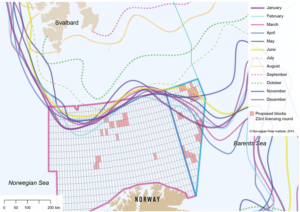
Monthly maximum sea ice extent for the period 1984-2013. Suggested licenses in the 23rd licensing round are shown as squares on the map.

Monthly maximum sea ice extent for the period 1984-2013. Suggested licenses in the 23rd licensing round are shown as squares on the map.


The 23rd licensing round for oil and gas prospecting in the south-eastern part of the Barents Sea opens the door for petroleum activities further northwards than ever before. In a consultative statement to the Norwegian authorities, the Norwegian Polar Institute has pointed out the vulnerability of this region on account of the seasonal presence of sea ice and a general lack of knowledge of the area and its variability. The proposed hydrocarbon exploration areas will be closer to vulnerable seabird colonies on the island of Bjørnøya (Spitsbergen archipelago), closer to the maximum extent of sea ice, overlapping the Polar Front, in the south-eastern part of the Barents Sea and partly within areas which have been defined as particularly valuable and vulnerable in the Integrated Management Plan for the Norwegian Part of the Barents Sea and the Areas outside Lofoten.
The Institute has also highlighted the need for increased preparedness for oil spills and other accidents in the region.