Tag Archives: Last Ice Area

Overnight sailing, Arctic style

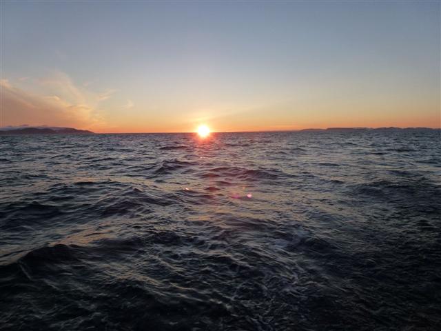
Arctic sunset © Martin von Mirbach / WWF-Canon


Our captain, Grant Redvers, is nothing if not safety-conscience.  And that suits me just fine, especially here in Arctic waters, where rescue capacity is severely limited.  So when Grant “suggests” the best time to make an open water crossing, we are eager to accept his recommendation.  The sail from Cobourg Island in the mouth of Jones Sound to the southeastern corner of Devon Island, at the mouth of Lancaster sound, is one of those open water crossings.  And, after checking and re-checking the wind forecasts, Grant reasoned that the best time to start the crossing would be in the later afternoon, sailing through the night.
Whenever we’re underway there are always at least two people “on-duty;” including one of the core crew members and one WWF-appointed participant.  My “duty roster” was from midnight to 2am, so I took a wee rest after dinner, both in order to relax but also because the first part of the crossing was pretty rough, and lying prone in your bunk is one of the better ways to avoid seasickness.
As I was resting in my bunk, however, I noted the slow but steady change in the quality of light.  So I decided to go up on deck a bit early, to see if the sun would set.  On the one hand, we’re almost ten degrees north of the Arctic Circle, in a realm of continual daylight during the summer.  On the other hand, we’re exactly  two thirds of the way from the summer solstice (June 21) to the autumn equinox (September 21).  On the equinoxes the axis of the Earth is aligned with its orbit around the Sun, and everybody on earth gets twelve hours of sun.  The only exception to this is at the North and South poles, where the sun rises and/or sets at the spring and autumn equinoxes.
So, the question I wanted answered is – does the sun set on August 21st, at 76 degrees north, or does it stay above the horizon?  There are, of course charts and programs that can give me this information, but I wanted to see for myself, so I bundled up against the cold and ventured on deck shortly after 11pm.  Sure enough, the sun was almost grazing the horizon, and by 11:30pm had set entirely, after a long an lovely sunset.

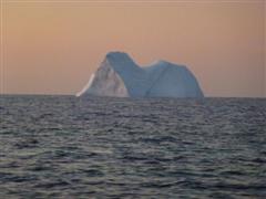
Iceberg at sunset © Martin von Mirbach / WWF-Canon


So, that answered my question, but also illustrated another interesting characteristic of light in the polar regions.  In the tropics, the sun sets at a sharp angle, so that it quickly becomes pitch dark after sunset.  In the polar regions, on the other hand, the sun sets at a shallow angle, so that even long after sunset it’s still just below the horizon, and so continues to illuminate the sky long past sunset.  This  is what filmmakers call “the magic hour,” but in the Arctic it lasts much longer than an hour, making for some lovely conditions to photograph icebergs in unusual light.
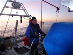
All in all, it made for a pleasant evening at the helm, and was a great opportunity for me and Pascale Otis, our awesome First Mate) to talk about all kinds of things while keeping each other awake and alert, and the boat on a steady course.

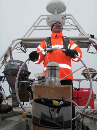
Martin at the helm. © Pascale Otis / WWF-Canon


My final question of the night was this: when will the sun rise?  Will it rise again before the end of my shift?  Pascale checked the computer and provided the informed opinion that the sun would rise at 3:23am.  As for me, I didn’t get to see the sunrise, since when my shift ended at 2am I was all too happy to dive into my sleeping bag and slowly warm my toes.  Nonetheless, the experience vividly illustrated some of the fundamental characteristics that make the Arctic a special place.  Anthropogenic greenhouse gas emissions may be warming the Arctic twice as quickly as the global average, but the patterns of dawn, daytime and twilight remain utterly unchanged by the collective presence of seven billion of us.
 

The final leg begins

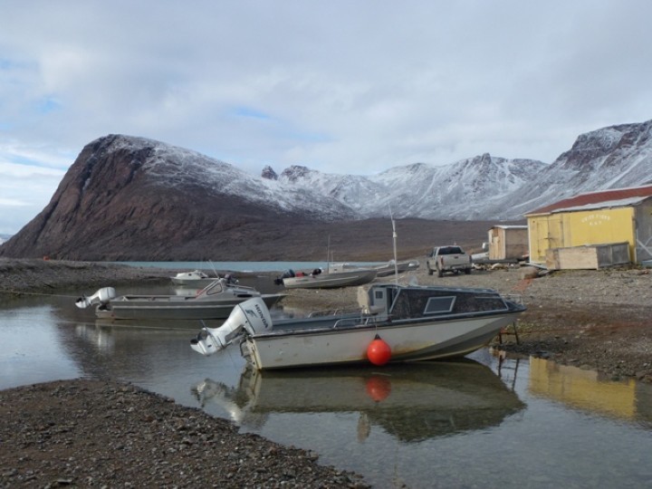
Grise Fiord, Nunavut. © Martin von Mirbach / WWF-Canon


Resolute Bay and Grise Fiord are Canada’s northernmost communities, with Grise sitting at 76 degrees North. Neither community came into being through an organic process of settlement, but were created in the middle of the last century, as part of a federal government program aimed at asserting Canadian sovereignty over the High Arctic Archipelago. (Resolute Bay is on Cornwallis Island and Grise Fiord on the southern coast of Ellesmere Island.) The belief at the time was that without permanent settlements on these islands the case could be made by other countries that the islands do not “belong” to Canada. This despite archaeological evidence of human occupation of Ellesmere Island since time immemorial but (as in places like the Middle East) archaeological evidence is considerably less persuasive than “facts on the ground.”
This raises an interesting question about how to assert sovereignty over a vast region like the Arctic. Is it best achieved by building communities, as in the examples of Resolute Bay and Grise Fiord? Is it enough to simply plant a flag like in the olden days of exploration, as the Russians have done at the North Pole? Or is it necessary, as Prime Minister Harper has stated, to “use it or lose it”? There may be a better way, and there’s a nearby Canadian example; namely, Quttinirpaaq National Park on Northern Ellesmere Island. Part of the rationale for creating this park was also tied to sovereignty issues, but in this case the thinking was that Canada could best assert its sovereignty by acting decisively to conserve the region.
This is surely an effective way to demonstrate sovereignty, and it needn’t be limited to creating a new protected area. Responsible stewardship allows for development to take place, but development is carefully planned in order to conserve ecological and social values, both now and into the future. In the rapidly changing Arctic environment this is an increasingly important priority. Moreover, the High Arctic – including northern Greenland, the Canadian High Arctic archipelago and associated waters (what WWF has dubbed the ‘Last Ice Area’) – offers a globally unique opportunity to practice such stewardship. We’re looking forward to see the region for ourselves, and to listen to the people living closest to the region to tell us about their hopes and aspirations.

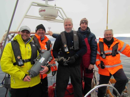
The tube team

The tube team – paul, Clive, Nick Clark, Grant Redvers, Maurice Roper (Valentine Ribadeau-Dumas was also on the team, but took the picture after we got the successful 500 meter sample. © Students on Ice / WWF-Canon


The wind howls down the glacier opposite, heeling the boat over and rattling the rigging. We’ve had to hide from bad weather yet again, having made the crossing in the only good weather on the horizon. The crew has tried hard to make anchorages stick, but the anchor just drags disappointingly away. Without an anchor, we have to trace circles in this relatively protected cleft in the rocks.
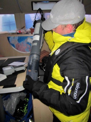
Then, a bright spot on the horizon widens, the wind drops, and we take the opportunity to trace the remainder of our route to Grise Fiord. But on the way, the wind drops. Researcher Paul Wilkinson shakes me awake just before 4 am – Clive, can you come help – I drag myself onto deck, along with most of the rest of the crew. It’s finally calm enough, and the water deep enough for Paul’s research. He has to drop a long metal tube down into the water, that then snaps shut to sample water at different depths. Then begins the laborious business of dragging the full metal tube back up to the surface. At the deepest sample, almost half a kilometer goes down, and it takes several people in turn to haul it back up.

Paul Wilkinson prepares a sample tube. © Students on Ice / WWF


Paul will later filter the samples, and then back in the lab, he will sequence the DNA found in the filters. What he’s looking for is the lowest part of the Arctic marine food web, microscopic plants. These plants become food for microscopic animals, and fed larger animals up the food chain, culminating in the whales and polar bears. These tiny plants get nowhere near the attention of larger animals, but they are just as important to the future of life in the last ice area. We expect Paul’s work to help in our efforts to predict how life up here may change or persist.
From here, out trip is almost over – we would like to try for seeing more marine life, but (what else is new) more bad weather is forecast, so were looking for a relatively protected spot near Grise Fiord, so those of us on the second leg can catch the twice-weekly plane, and the participants in leg 3 can make it onboard, and continue the Tern’s journey.

Sailing through Siku

Sea Ice © Clive Tesar / WWF-Canon


The storm was steadily eating into our travel plans. The first day at anchor meant we had to ditch plans to call in at Siorapaluk, Greenland’s northernmost community. The second day made things tight for catching our connections at Grise Fiord.

Clive steers through a snowstorm. © Students on Ice / WWF-Canon


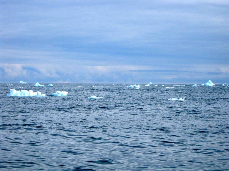
That’s why we are still traveling, more than 24 hours, about 160 miles, and many bleary watches on bridge later, completing the crossing from Greenland to Canada. The beginning of the trip was uncomfortable, the rain turning to snow, blowing directly into our faces as we steered. Then as we came into sight of the steep snow and glacier-clad hills of Ellesmere Island, we saw what we’d come for; I reckon that’s sea ice, said Grant casually, waving an arm at some flatter ice debris off our bow.
Based on the satellite ice maps, we thought we might encounter a tongue of sea ice in the middle of the channel, pushing down from higher latitudes. We didn’t see it. We know that recent news has confirmed what many ice researchers had suspected – that the ice mass (that’s the total amount of ice, not the area it covers) has been declining drastically. This means that a lot of the ice that’s out there is thinner than it used to be, so what seemed a solid body of ice a day ago, is now just fragments bobbing on the surface. It’s rather anticlimactic to be sailing toward what we thought was the sea ice habitat that we hope will persist, only to have it melt away before us.

The tern on the Tern

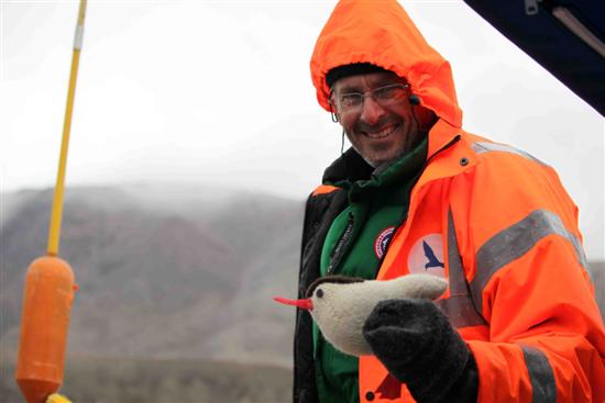
Maurice and Bird Yarns tern © Clive Tesar / WWF-Canon


Boats tend to accumulate mascots, and this one has more than its share, mostly crafted by crew-member Pascale Otis: at the moment, she’s working on a family of ice-worms, handcrafted from some sealskin scraps.
But one of the mascots has already made a long journey just to join us here. It’s a hand-knitted arctic tern from Cape Farewell, a British organization promoting awareness of climate change through arts and culture. The organization heard of our trip on the Arctic Tern, and sent us a tern for the journey, one of a whole flock  created to bring attention to the changing migration patterns of seabirds across Scotland’s islands, through the Bird Yarns project.
Even though it has traveled from where it was knitted in the north of Scotland, by post to Ottawa, then carried by air to Greenland and by boat to Arctic Canada, the knitted tern has still not equaled the travels of its real life model. The real Arctic Tern migrates annually from the Arctic to the Antarctic, an astonishing 71,000 kilometer round trip.
When our trip is over, we intend to return this knitted Tern to rejoin its flock in the U.K., together with a record of its travels with us. It will carry back the story of its traverse of the fringes of the Last Ice Area.

Waiting to cross

We head out again on the morning of August 12 after a windy night at anchor.   After several hours of rain and wind, we find a relatively safe place in Mac Cormick fjord. Here the wait begins for the crew – waiting for the wind to die down, and ideally the sea too, so we can leave. The night is calm but in the morning, and against all odds, the wind increases and we are stuck here. We take our shifts on watch: if anything changes, wake the captain!
So here we are on this beautiful Monday, waiting, well anchored, and listening to the wind to tell us our schedule.
Next Stop: Canada. We leave Greenland with a great desire to return to the many beautiful places and wonderful people we’ve encounter along the way.

Ancient sandstone, oil futures, and odd sounds from the gearbox

Pointing across the bay, Christian Knudsen, a geologist working for the Danish geological survey, enthuses over the ancient sandstone cliffs. These cliffs, he says, date from Precambrian times. Christian is in Qaanaaq, part of a survey team looking at many aspects of Greenland’s geology, but right now, they’re focused on implications of that geology for oil and gas potential.
We’re in Qaanaaq for another day because the Tern’s gearbox has been behaving a little oddly. Grant, the captain, wants to be sure that the boat is up to the long crossing to Grise Fiord before venturing further out. He’s getting a second opinion from a local mechanic, Mads, who operates the town’s diesel-fired electricity plant.
West of here, a consortium of oil companies led by Shell is preparing to do some ‘research drilling’ that further assist in assessing the likelihood of oil and gas potential. These companies have all received claim blocks from the Greenland government, allowing them to explore for oil.
Although our trip is partly powered by oil products, and the town obviously relies on an oil product also for its light and heat, the prospect of drilling in these waters is alarming. Watching the constant procession of large icebergs drift by, it doesn’t take too much imagination to picture what might happen if one of them were to hit a drilling rig. And seeing the connection of the local people to these surroundings, the pride they take in continuing a viable hunting culture that stretches back over generations is a reminder of what stands to be harmed.
That doesn’t mean I’m opposed to what the geologists are doing. If we truly want to respect the interests of local people, we might wish them to conserve this area as far as possible, but we also believe that their decisions should be informed. That information includes what lies beneath the local rocks, as well as what lives within their waters.

The narwhal hunt

We had just stepped ashore in Qeqertat when the small boat approached the beach, dodging its way in between icebergs. Strapped across its bows was a traditional hunting kayak, with a harpoon and sealskin float attached. Trailing behind the three men in the boat was a narwhal, the fruit of the hunt.
We had come to Qeqertat, a small island community several kilometers from Qaanaaq in Northwest Greenland in our search for wildlife on the fringes of the Last Ice Area. We were told in Qaanaaq that narwhal were to be found in the area at this time of year. We were also warned off going further into the Fjord than Qeqertat, as people were worried that we would disrupt the hunt by our presence.
Clive Tesar of WWF and Nick Clark of Al Jazeera English
on the Last Ice Area and visiting Qeqertat:

On our way in yesterday, we scanned the waters, but saw no sign of the famous tusked whales. Now here in front of me was evidence that they not only inhabit the area, but also help support this community in pursuing a traditional lifestyle and economy.
Some of the whale was shared out immediately with the small cluster of people who ran down to the beach.  Other parts were cut and hung from platforms to dry. A final portion was packed up and set aside for transport to Qaanaaq, to be frozen and sold.
When people took a break from their chores, I took the opportunity to pass out some information on our trip, and on the last ice area in both Greenlandic and Danish. I also spoke with a couple of the local people who spoke English.  One of the women, Nina, read out parts of the information to the other people on the beach. She later told me that they would like to talk further to WWF about the information we had brought, but they would first like some time to absorb it. In the months and years to come, we certainly hope to speak more with the people of Qeqertat, and with the other people living on the fringes of the last ice area.

To the ice edge

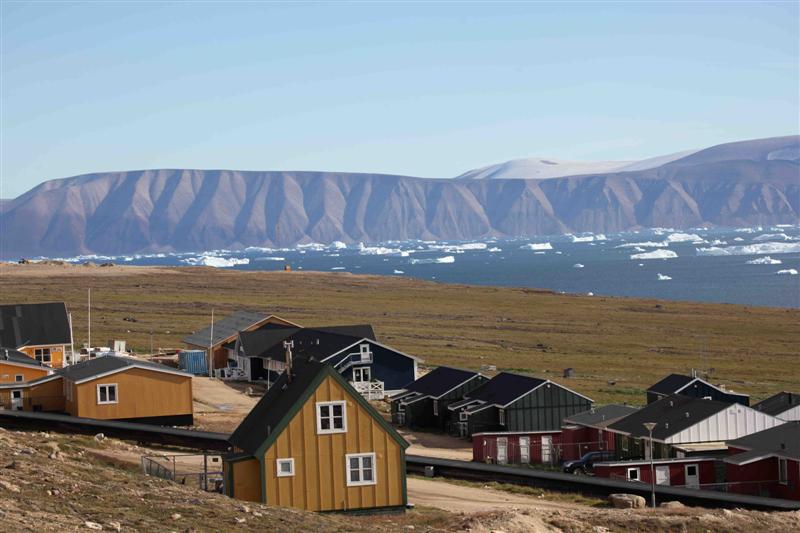
Houses in Qaanaaq, Greenland. © Clive Tesar / WWF-Canon


After the relative lushness of southern Greenland, the first glimpses of the north of the island are shocking. Here about 1400 kilometers from the North Pole is a virtual polar desert. Ice cascades off the top of barren rock domes, glowing gown to the sea as glaciers that sometimes become sudden turbulent rivers for a brief span. In the sea, tall icebergs sail past, not as thickly packed as in Ilulissat, but still hazardous to shipping. We’re sitting now just offshore of Qaanaq, a community of about a hundred buildings perched on what seems to be the single patch of greenery.
Our mission for this second leg is not so much to interact with the communities – there is only one tiny community north of here, and our only Greenlandic speaker has just left the boat. Our mission instead is to explore this edge of the last ice area.
The ice at present is only several kilometers to our north, where we hope it will stay, not just this year, but for many years to come. We will explore around the edges of it, to see how much life is using it now. We’ve heard that we may see both narwhal and walrus in the area. In the days to come, we will try to track these elusive creatures, and watch the Arctic desert come alive.

Bringing the Arctic to the desert

Nick Clark and Maurice Roper from Al Jazeera film on the voyage to the Last Ice Area in August 2012. © Clive Tesar / WWF-Canon


Through the helicopter’s open door, several kilometers of fractured ice stretch to the horizon – leaning into this landscape is Maurice, a cameraman for Al Jazeera. Up front beside the pilot is Nick, the reporter. Al Jazeera is a relatively new international television network based in the middle-eastern country of Qatar.
The television crew is coming along on the second leg of the Tern trip, but beforehand, they’ve flown with me from Iqaluit to Ilulissat. Juggling scarce northern flights has meant a two-day stopover in Ilulissat, but this is no hardship. The town on the west coast of Greenland is right next door to a world heritage site, the Ilulissat icefjord.
This glacier, about 9 kilometers wide, and 1.5 kilometers high at the face is the most productive in the northern hemisphere. Recent measurements have shown the glacier speeding toward the sea at a rate of 60 meters per day, a sprinter by glacier standards. When it hits the sea, it hurls down massive chunks of ice. Some are the size and shape of a supermarket, while others form fantastic shapes like cathedrals of ice with jagged glittering spires.
The Al Jazeera crew avidly films the frozen landscape. They will likely use some of this footage later this year. In November, the next round of international negotiations takes place in Doha, home base for the network. This coverage is part of what we had hoped for from this trip; to bring Arctic observations and voices to the attention of the global community.
As the Greenlandic ice cap speeds toward the sea,  the glacial pace of international climate action must also pick up, if we are to preserve the unique character of the Arctic.