Monthly Archives: August 2012

Too many narwhals to count

A narwhal (Monodon monoceros) surfacing for breath in the Arctic, Canada. © WWF / Paul Nicklen, National Geographic Stock


My last watch on the Arctic Tern 1 was from 2-4AM on August 30. I was on deck with Pascal, first mate. We were motoring the sailboat into Eclipse Sound, there was no wind, the ocean completely calm. We glided through many fog patches, straining our eyes in the half darkness searching for growlers and ice bergs. A few seabirds were active even at this time of night, including the occasional dovekie, the smallest seabird in the Canadian Arctic. At some point during my watch the almost full moon rose, its light diffused by the fog.
We noticed some ripples on the port side – seals? Then more ripples with the arch of a surfacing whale – narwhals! We watched them pass, traveling in the opposite direction. Too many to count, better to enjoy the encounter.  Eclipse Sound is well known for its large population of narwhal. WWF has partnered with the Pond Inlet Mittimatalik Hunter and Trapper Organization and the Department of Fisheries and Oceans to study narwhal. For the past two years satellite tags have been attached to narwhal to study their movements. Narwhal are a sea ice associated species. Unlike the beluga and orca, narwhal remain north in Baffin Bay throughout the winter, feeding amongst the pack ice floes and leads. A resident species of the Last Ice Area.

Lancaster Sound, past, present and future

By the time of my 11pm shift on watch we were well up towards the mouth of Admiralty Inlet, sailing into a light headwind through dark and foggy skies.  Night-time darkness has been a relative rarity on this trip, but at this time of year the days are growing shorter at a rapid rate.  Steering a steady course under these conditions is considerably more challenging, since there are no landmarks to serve as guideposts.  Instead of being guided by a landmark, it was necessary to be guided by the wind, which proved considerably more difficult for a landlubber like myself.  Unused to the slow response to direction changes from the helm, I found myself continually oversteering, and zigzagging back and forth.  Grant, our captain, patiently guided me in developing the right touch, and anticipating the changing orientation of the boat, the sails and the wind.  With some practice, I gradually managed to reduce some of the wilder swings of direction, but have a long way to go before I can claim genuine competence in this regard.
The low visibility compounded the challenge of avoiding the “bergy bits” and “growlers” – fragments of icebergs that, although small, are nevertheless best avoided.  When you’re in a small boat in a cold ocean and many hours away from any possible rescue, the last thing you want to hear is something crunching against the hull.  All in all, despite the flat homogeneity of the terrain, it’s very difficult to fall asleep at the helm; there’s always something to watch out for.
My next shift was at 7am, and by then we were in Lancaster Sound, sailing through waters that were flat calm.  Lancaster Sound was failing to live up to its fierce reputation.  We were sailing on autopilot and my task was the relatively simple one of spotting and avoiding the occasional pieces of ice.
I had the time to think about where we are.  Anyone who has gone through the Canadian school system will have heard countless stories about the search for the Northwest Passage and its role in the European colonization of this vast continent.  Lancaster Sound is the eastern opening of the Northwest Passage, although it took numerous voyages to establish that it would prove necessary to cross over the top of Baffin Island, since Hudson Bay offered no practical western passage.

Two narwhal (Monodon monoceros) surfacing to breathe in Admiralty Inlet, Lancaster Sound, Nunavut, Canada. © Paul Nicklen/National Geographic Stock / WWF-Canada


Lancaster Sound is a vast channel, more than forty nautical miles wide, and must have been a formidable challenge for Inuit hunters to cross on foot or by kayak.  However, it was attractive to these rugged hunters since it’s abundant in whales, especially the legendary narwhal (although they’ve proved elusive to us!).
Today, Lancaster Sound is the site of a proposed National Marine Conservation Area.  Further research and consultation with local communities will be required before this conservation area is formally established, but it will provide important protection for the narwhal, beluga and bowhead whales that spend their summers here.  Moreover, Lancaster Sound could provide the southern foundation for a vast multi-zoned complex of special management areas, aimed at conserving ecosystem resilience in a rapidly changing Arctic environment.  While summer sea ice disappears from much of the Arctic, and the period of annual ice cover shrinks dramatically, the high Arctic of northern Canada and Greenland – the ‘Last Ice Area – is likely to become increasingly significant in providing secure habitat for ice-dependent species.  Conserving this habitat – while allowing for responsible development – provides Nunavut and Greenland with a unique opportunity to demonstrate Arctic stewardship.

Arctic Bay, Nunavut

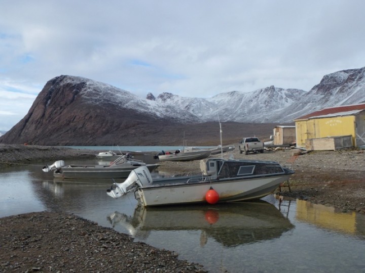
Arctic Bay, Nunavut. © Students on Ice / WWF-Canon


By Martin von Mirbach and Vicki Sahanatien, members of the Last Ice Area voyage
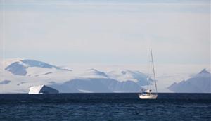
It took 24 hours to sail from Devon Island to Arctic Bay on northern Baffin Island. We crossed Lancaster Sound and entered Admiralty Inlet under good wind and sea conditions. Admiralty Inlet opens southeast off Lancaster Sound, separating the Borden and Brodeur Peninsulas. We sailed partway down the inlet before turning into Adams Sound and then into the perfect sheltered harbor of Arctic Bay.
Icebergs appeared and disappeared as we sailed but the star attraction of the crossing was an ice island – a large flat shelf of ice several kilometers square. We found out later from the ice observer on the Coast Guard ship Terry Fox that it was a fragment of the huge ice island that calved off the Peterman Glacier of northwestern Greenland in 2010.
Arctic Bay was our first community since leaving Grise Fiord a week ago. It was time to resupply with fuel, water and fresh meat, fish, fruit and vegetables. We also took this opportunity to meet people in the community to learn about the latest news.
We stopped by the Hamlet office and found that Clare Kines, the Economic Development Officer was at his office at the Heritage Centre. So off we trekked to find Claire and learn about Arctic Bay’s economy. Arctic Bay is a medium sized community, with about 800 people. It is a community in transition, since the Nanisivik mine shut down several years ago. Arctic Bay and Nanisivik were connected by Nunavut’s only road and by employment, recreational activities and family. Some of the skilled workers are still without local employment. The future? People look toward the proposed Mary River iron ore mine and potential opportunities that will arise.
Next, it was the offices of the Ikajutit Hunter and Trapper Organization (HTO), where we met Jack Willie the HTO office manager. Here we heard details of the successful bowhead whale hunt. Arctic Bay hunters brought in their bowhead in record time: 35 minutes from harpooning to towing the whale into shore. We had hoped to meet the hunt captain, Tommy Tatuapik but he was out of town. It was also narwhal hunting season. One of the hunters dropped by with two narwhal tusks for the HTO manager to measure and register. HTOs manage the community narwhal quota by allocating tags to the hunters. The narwhal hunt, like all quota limited hunts in Nunavut, is regulated by the Nunavut Wildlife Management Board and the responsible federal or territorial department.
Other encounters in the town were more informal. Each time our zodiac came ashore we were greeted by a band of children, who were curious about our boat and asked to be taken aboard. Two zodiac loads of kids came to the Arctic Tern and they were fascinated by the differences between a sailboat and the motor boats of Arctic Bay.

Crossing Lancaster Sound

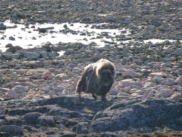
Muskox, Devon Island. © Martin von Mirbach / WWF-Canon


By Martin von Mirbach and Vicki Sahanatien, members of the Last Ice Area voyage
For the past few days we’ve been exploring Lancaster Sound, the eastern entrance to the Northwest Passage.  Our first sheltered harbor was in a protected bay on the southeastern corner of Devon Island.  A short shore walk took us to within close range of four muskox, but our arrival was noted with some displeasure before the biggest male of the group “walked us off” his property in no uncertain manner.
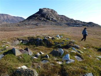
Wildlife were not the only occupants of this perfect harbor. In the 1940s this was the site of the Dundas Harbour RCMP post. The post buildings still stand and remain remarkably sturdy. Stone walkways link the buildings and lead the way to the nearby cemetery where two RCMP officers were laid to rest. Inside the main post building is a written commemoration to the young officers who manned the post.

© Martin von Mirbach / WWF-Canon


People have used Dundas Harbour for many centuries. Prior to the RCMP, Inuit camped and hunted here. 20th century and recent tent rings dot the shoreline and raised beaches, as well as evidence of ancient human use – the Thule. We found three Thule sod houses, intact with the bowhead whale bones that were used to construct the houses. We marveled at this evidence that many centuries ago the Thule hunted 70 tonne bowhead whales using kayaks and harpoons. Seeing these sites demonstrates that this region, like much of the Canadian Arctic is not and never was uninhabited wilderness.
Taking advantage of the continuing stable weather, we set sail that evening along the southern coast of Devon Island, The waters are almost entirely ice-free, except for the occasional iceberg, some of which are large and magnificent.

Devon Island, Nunavut

Giant iceberg near Devon Island © Students on Ice / WWF-Canon


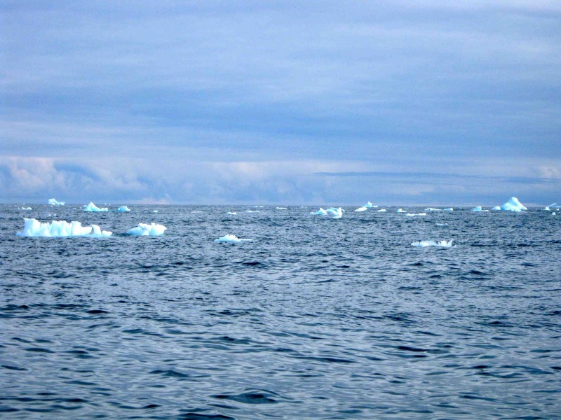
We sailed the Arctic Tern I overnight from Cobourg Island to Queen Aba Harbour on eastern tip of Devon Island. The wind was light but sufficient to sail until sometime after midnight – the wind dropped off and we had to make use of engine power. Jones Sound was free of sea ice but there were many icebergs to be aware of as we sailed. Icebergs are not sea ice, but the progeny of glaciers that reach into the sea. The icebergs we sailed by may have been locally generated, as there are many glaciers that dip their toes into the ocean

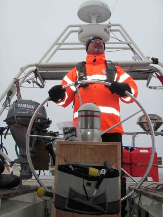
Martin at the wheel © Students on Ice / WWF-Canon


on southern Ellesmere Island and Devon Island, or they may have originated in  northwestern Greenland.
When sailing overnight we take 2 hour shifts on watch with the Captain or one of the mates. We assist by watching for ice, checking the navigation equipment, and steering the sailboat.  As we work, each of us takes in the extraordinary beauty of the sea and adjacent islands. The sunset last night but just dipped a bit below the horizon, which meant we did not experience darkness,  just a lower level of light. 24 hour daylight! Its presence permits us to continue exploring the most easterly part of the Last Ice Area around the clock.

The Tern in Queen Aba Harbour. © Students on Ice / WWF-Canon


Sea birds keep us company as we sail: thick-billed murres, black guillemots, glaucous gulls, and the most plentiful, northern fulmar. The fulmars appear to enjoy our company too, as they fly close by the sailboat: coming alongside, zooming past the bow and stern. We keep an eye out for the rare Ivory Gull as we travel. Our marine mammal observations have been sparse, with a single walrus checking us out at lunch while we were anchored in Queen Aba Harbour, and ringed seals popping up as we sail. We just began our 2nd overnight sail, heading to Lancaster Sound. Our route will follow the southern shore of Devon Island on our way to Arctic Bay. The upcoming waters are known for their rich biodiversity and we anticipate observing whales, walrus, seals, polar bears, and many more seabirds.

Overnight sailing, Arctic style

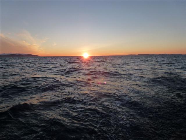
Arctic sunset © Martin von Mirbach / WWF-Canon


Our captain, Grant Redvers, is nothing if not safety-conscience.  And that suits me just fine, especially here in Arctic waters, where rescue capacity is severely limited.  So when Grant “suggests” the best time to make an open water crossing, we are eager to accept his recommendation.  The sail from Cobourg Island in the mouth of Jones Sound to the southeastern corner of Devon Island, at the mouth of Lancaster sound, is one of those open water crossings.  And, after checking and re-checking the wind forecasts, Grant reasoned that the best time to start the crossing would be in the later afternoon, sailing through the night.
Whenever we’re underway there are always at least two people “on-duty;” including one of the core crew members and one WWF-appointed participant.  My “duty roster” was from midnight to 2am, so I took a wee rest after dinner, both in order to relax but also because the first part of the crossing was pretty rough, and lying prone in your bunk is one of the better ways to avoid seasickness.
As I was resting in my bunk, however, I noted the slow but steady change in the quality of light.  So I decided to go up on deck a bit early, to see if the sun would set.  On the one hand, we’re almost ten degrees north of the Arctic Circle, in a realm of continual daylight during the summer.  On the other hand, we’re exactly  two thirds of the way from the summer solstice (June 21) to the autumn equinox (September 21).  On the equinoxes the axis of the Earth is aligned with its orbit around the Sun, and everybody on earth gets twelve hours of sun.  The only exception to this is at the North and South poles, where the sun rises and/or sets at the spring and autumn equinoxes.
So, the question I wanted answered is – does the sun set on August 21st, at 76 degrees north, or does it stay above the horizon?  There are, of course charts and programs that can give me this information, but I wanted to see for myself, so I bundled up against the cold and ventured on deck shortly after 11pm.  Sure enough, the sun was almost grazing the horizon, and by 11:30pm had set entirely, after a long an lovely sunset.
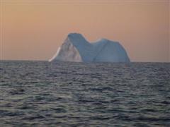
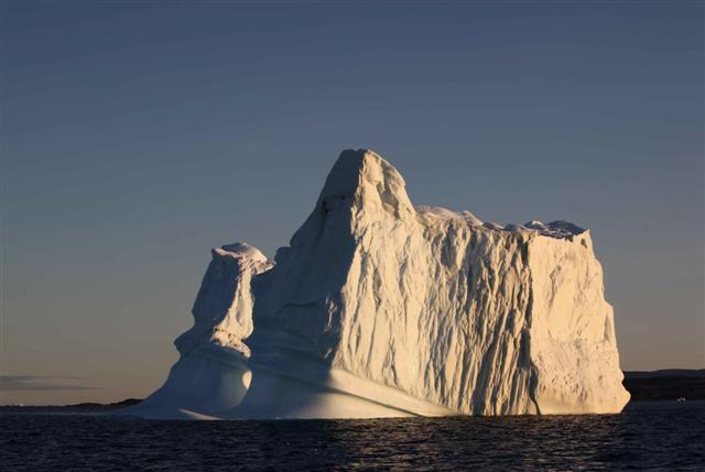
Iceberg at sunset © Martin von Mirbach / WWF-Canon


So, that answered my question, but also illustrated another interesting characteristic of light in the polar regions.  In the tropics, the sun sets at a sharp angle, so that it quickly becomes pitch dark after sunset.  In the polar regions, on the other hand, the sun sets at a shallow angle, so that even long after sunset it’s still just below the horizon, and so continues to illuminate the sky long past sunset.  This  is what filmmakers call “the magic hour,” but in the Arctic it lasts much longer than an hour, making for some lovely conditions to photograph icebergs in unusual light.
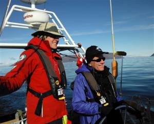
All in all, it made for a pleasant evening at the helm, and was a great opportunity for me and Pascale Otis, our awesome First Mate) to talk about all kinds of things while keeping each other awake and alert, and the boat on a steady course.
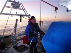
Martin at the helm. © Pascale Otis / WWF-Canon


My final question of the night was this: when will the sun rise?  Will it rise again before the end of my shift?  Pascale checked the computer and provided the informed opinion that the sun would rise at 3:23am.  As for me, I didn’t get to see the sunrise, since when my shift ended at 2am I was all too happy to dive into my sleeping bag and slowly warm my toes.  Nonetheless, the experience vividly illustrated some of the fundamental characteristics that make the Arctic a special place.  Anthropogenic greenhouse gas emissions may be warming the Arctic twice as quickly as the global average, but the patterns of dawn, daytime and twilight remain utterly unchanged by the collective presence of seven billion of us.
 

The final leg begins

Grise Fiord, Nunavut. © Martin von Mirbach / WWF-Canon


Resolute Bay and Grise Fiord are Canada’s northernmost communities, with Grise sitting at 76 degrees North. Neither community came into being through an organic process of settlement, but were created in the middle of the last century, as part of a federal government program aimed at asserting Canadian sovereignty over the High Arctic Archipelago. (Resolute Bay is on Cornwallis Island and Grise Fiord on the southern coast of Ellesmere Island.) The belief at the time was that without permanent settlements on these islands the case could be made by other countries that the islands do not “belong” to Canada. This despite archaeological evidence of human occupation of Ellesmere Island since time immemorial but (as in places like the Middle East) archaeological evidence is considerably less persuasive than “facts on the ground.”
This raises an interesting question about how to assert sovereignty over a vast region like the Arctic. Is it best achieved by building communities, as in the examples of Resolute Bay and Grise Fiord? Is it enough to simply plant a flag like in the olden days of exploration, as the Russians have done at the North Pole? Or is it necessary, as Prime Minister Harper has stated, to “use it or lose it”? There may be a better way, and there’s a nearby Canadian example; namely, Quttinirpaaq National Park on Northern Ellesmere Island. Part of the rationale for creating this park was also tied to sovereignty issues, but in this case the thinking was that Canada could best assert its sovereignty by acting decisively to conserve the region.
This is surely an effective way to demonstrate sovereignty, and it needn’t be limited to creating a new protected area. Responsible stewardship allows for development to take place, but development is carefully planned in order to conserve ecological and social values, both now and into the future. In the rapidly changing Arctic environment this is an increasingly important priority. Moreover, the High Arctic – including northern Greenland, the Canadian High Arctic archipelago and associated waters (what WWF has dubbed the ‘Last Ice Area’) – offers a globally unique opportunity to practice such stewardship. We’re looking forward to see the region for ourselves, and to listen to the people living closest to the region to tell us about their hopes and aspirations.

The tube team

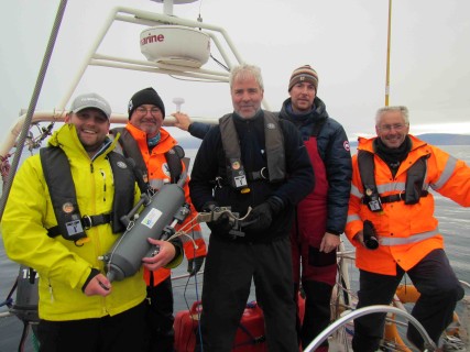
The tube team – paul, Clive, Nick Clark, Grant Redvers, Maurice Roper (Valentine Ribadeau-Dumas was also on the team, but took the picture after we got the successful 500 meter sample. © Students on Ice / WWF-Canon


The wind howls down the glacier opposite, heeling the boat over and rattling the rigging. We’ve had to hide from bad weather yet again, having made the crossing in the only good weather on the horizon. The crew has tried hard to make anchorages stick, but the anchor just drags disappointingly away. Without an anchor, we have to trace circles in this relatively protected cleft in the rocks.
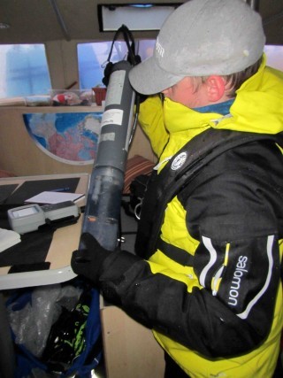
Then, a bright spot on the horizon widens, the wind drops, and we take the opportunity to trace the remainder of our route to Grise Fiord. But on the way, the wind drops. Researcher Paul Wilkinson shakes me awake just before 4 am – Clive, can you come help – I drag myself onto deck, along with most of the rest of the crew. It’s finally calm enough, and the water deep enough for Paul’s research. He has to drop a long metal tube down into the water, that then snaps shut to sample water at different depths. Then begins the laborious business of dragging the full metal tube back up to the surface. At the deepest sample, almost half a kilometer goes down, and it takes several people in turn to haul it back up.

Paul Wilkinson prepares a sample tube. © Students on Ice / WWF


Paul will later filter the samples, and then back in the lab, he will sequence the DNA found in the filters. What he’s looking for is the lowest part of the Arctic marine food web, microscopic plants. These plants become food for microscopic animals, and fed larger animals up the food chain, culminating in the whales and polar bears. These tiny plants get nowhere near the attention of larger animals, but they are just as important to the future of life in the last ice area. We expect Paul’s work to help in our efforts to predict how life up here may change or persist.
From here, out trip is almost over – we would like to try for seeing more marine life, but (what else is new) more bad weather is forecast, so were looking for a relatively protected spot near Grise Fiord, so those of us on the second leg can catch the twice-weekly plane, and the participants in leg 3 can make it onboard, and continue the Tern’s journey.

Sailing through Siku

Sea Ice © Clive Tesar / WWF-Canon


The storm was steadily eating into our travel plans. The first day at anchor meant we had to ditch plans to call in at Siorapaluk, Greenland’s northernmost community. The second day made things tight for catching our connections at Grise Fiord.

Clive steers through a snowstorm. © Students on Ice / WWF-Canon


That’s why we are still traveling, more than 24 hours, about 160 miles, and many bleary watches on bridge later, completing the crossing from Greenland to Canada. The beginning of the trip was uncomfortable, the rain turning to snow, blowing directly into our faces as we steered. Then as we came into sight of the steep snow and glacier-clad hills of Ellesmere Island, we saw what we’d come for; I reckon that’s sea ice, said Grant casually, waving an arm at some flatter ice debris off our bow.
Based on the satellite ice maps, we thought we might encounter a tongue of sea ice in the middle of the channel, pushing down from higher latitudes. We didn’t see it. We know that recent news has confirmed what many ice researchers had suspected – that the ice mass (that’s the total amount of ice, not the area it covers) has been declining drastically. This means that a lot of the ice that’s out there is thinner than it used to be, so what seemed a solid body of ice a day ago, is now just fragments bobbing on the surface. It’s rather anticlimactic to be sailing toward what we thought was the sea ice habitat that we hope will persist, only to have it melt away before us.

The tern on the Tern

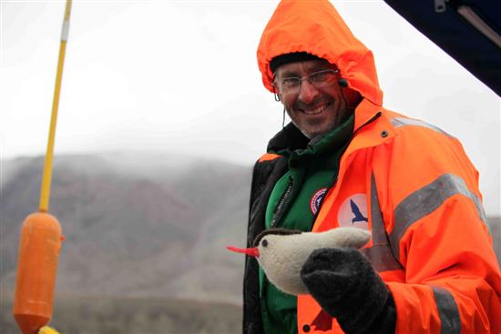
Maurice and Bird Yarns tern © Clive Tesar / WWF-Canon


Boats tend to accumulate mascots, and this one has more than its share, mostly crafted by crew-member Pascale Otis: at the moment, she’s working on a family of ice-worms, handcrafted from some sealskin scraps.
But one of the mascots has already made a long journey just to join us here. It’s a hand-knitted arctic tern from Cape Farewell, a British organization promoting awareness of climate change through arts and culture. The organization heard of our trip on the Arctic Tern, and sent us a tern for the journey, one of a whole flock  created to bring attention to the changing migration patterns of seabirds across Scotland’s islands, through the Bird Yarns project.
Even though it has traveled from where it was knitted in the north of Scotland, by post to Ottawa, then carried by air to Greenland and by boat to Arctic Canada, the knitted tern has still not equaled the travels of its real life model. The real Arctic Tern migrates annually from the Arctic to the Antarctic, an astonishing 71,000 kilometer round trip.
When our trip is over, we intend to return this knitted Tern to rejoin its flock in the U.K., together with a record of its travels with us. It will carry back the story of its traverse of the fringes of the Last Ice Area.